Saturday, March 31, 2012
Casita Video
Just a video today of the Casita. To go along with the photos I posted a day or so back:
Thursday, March 29, 2012
Inside the Casita
I don't remember the last time I posted interior photos of the Casita. So here are a few. We're in the process of getting it ready for a new season of trips, so it's a bit untidy. But it'll give you a good idea of what it's like inside our tiny travel trailer.
 Looking toward the bed. It converts to a four seat dining table, but we keep it made up as a bed, since it's almost always just me and Carole using the trailer. And we only need the two-seat dinette for meals.
 Another view looking down toward the rear of the trailer.
 Here's a shot indicating the air conditioner above. On the lower left you can see the vent for the heater. We have used the trailer often in winter, so it's good to have the propane heater. There's also a heat strip in the air conditioner, but of course that does you no good if you're in a campground that's primitive and doesn't have electric hook ups.
 The bathroom is a classic marine toilet affair. It serves as both the toilet and the shower. It's tall enough so that I can stand up in the room when I'm showering (I'm 5' 10" tall). And, of course, the storage box and bag is not generally in there when we're traveling.

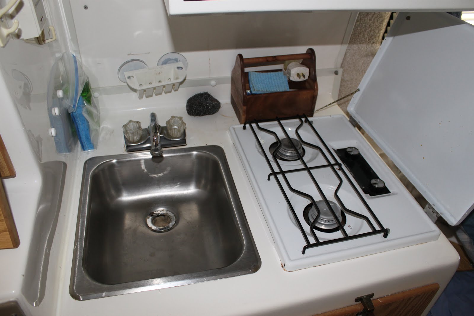
 The sink and two-burner stove.
 People are always amazed at the large size of the refrigerator and freezer. It runs on propane and electric.
 One of the storage areas that we use for food. It had a microwave in it, but we took it out since we don't like using a microwave oven. The space is better served (for us) as storage.
 And one of the many upper storage bins.
 Looking toward the bed. It converts to a four seat dining table, but we keep it made up as a bed, since it's almost always just me and Carole using the trailer. And we only need the two-seat dinette for meals.
 Another view looking down toward the rear of the trailer.
 Here's a shot indicating the air conditioner above. On the lower left you can see the vent for the heater. We have used the trailer often in winter, so it's good to have the propane heater. There's also a heat strip in the air conditioner, but of course that does you no good if you're in a campground that's primitive and doesn't have electric hook ups.
 The bathroom is a classic marine toilet affair. It serves as both the toilet and the shower. It's tall enough so that I can stand up in the room when I'm showering (I'm 5' 10" tall). And, of course, the storage box and bag is not generally in there when we're traveling.
Here is the bathroom sink and showerhead.
 The sink and two-burner stove.
 People are always amazed at the large size of the refrigerator and freezer. It runs on propane and electric.
 One of the storage areas that we use for food. It had a microwave in it, but we took it out since we don't like using a microwave oven. The space is better served (for us) as storage.
 And one of the many upper storage bins.
Wednesday, March 28, 2012
Some Wildlfowers
I don't know much about wildflowers. Almost nothing. But I often take photographs of them when I'm hiking. Here are a few I saw on my way to see the big cottonwood tree in Boone's Cave Park. I can't ID any of them, so if you know, post here.
 Very small. These blossoms were on a stalk about a foot high.
 These delicate blossoms were on a plant growing out of a spray of moss.
 This one was pretty much alone in the sun beside the trail.
 This was another very tiny flower that grew in bunches close to the ground.
 Very small. These blossoms were on a stalk about a foot high.
 These delicate blossoms were on a plant growing out of a spray of moss.
 This one was pretty much alone in the sun beside the trail.
 This was another very tiny flower that grew in bunches close to the ground.
Tuesday, March 27, 2012
Boone's Cave Park
I had some time off so I drove over to a spot near Lexington NC to see a park I'd heard about. It's called Boone's Cave Park and was once part of the state park system. However, it was owned by the state because it was claimed that Daniel Boone had lived at this location for a while. In his journals, he mentions that he lived in the Yadkin River Valley and had stayed for a time in a cave above the river and later built a cabin on the bluff overlooking the river where he lived for two years.
The locals claim that this place is the only location along the Yadkin River where such a cave exists and that they knew the location of the cabin. However, after the park was established no archeologist could ever verify that Boone (or anyone else) had lived either in the cave or at the site where the locals claimed Daniel Boone resided.
Therefore, after a while North Carolina removed the state park designation for the site and just kept it as state property with few improvements. In 2003 the state sold the 100-acre park to the Davidson County government. They have done a lot with the park and it's an interesting place, even if Daniel Boone never really lived there.
Bluffs stand high above the Yadkin River at this location. There is a point above the cave where you can stand and look down at the river and the lower opposing bank. The cave itself is of geologic interest as an outcropping of the local sandstone. Catawba rhododendron actually grows here--I've often noted that rhododendron will thrive in the Piedmont, but only if it can find rocky soil and steep slopes on which to grow. The cave here is such a place.
But the main reason I wanted to go to the park was that I'd heard that it had a particularly impressive cottonwood tree. I'm always on the lookout of notable old trees, so this was high on my list to view. When I got to the park I found that the river was up due to recent rains and also because the sluice gates had been opened on the dam upriver from the park. The park superintendent told me that the trail I was going to use to access the big tree was underwater and was unsafe so I had to take another route to find it.
And I'm glad that I did make the hike in. The tree was almost as impressive as the press had made it out to be. It has a very large circumference, but I doubt the claims of the park propagandists that it's "over 157 feet tall". I don't own a range finder to measure such trees (something I need to get in the future), but I've seen trees that have been measured to be in that range, and this one did not seem nearly that tall. But I could be wrong.
At any rate, if you have part of a day to spend hiking about and resting you could do a lot worse than Boone's Cave Park in Davidson County near Lexington.
 89 stairs leading down to the cave.
 The old man at the entrance to the cave.
 Part of the cave's interior.
 This spring emerges from the side of this hill on the hike in to see the big tree.
 Bottomland near the big tree.
 The area near the cottonwood tree is pretty boggy.
 And here I was at the base of the cottonwood tree.
 A composite shot of me standing with the huge cottonwood.
Monday, March 26, 2012
Read the Fine Print
One relatively easy hike that I took in Yellowstone in 2010 was the climb to the top of Mount Washburn and down the other side to the main loop road. I started on the Dunraven Pass Trail, climbed up to the summit ranger/weather station, and then used the Chittendon Road Trail to descend.
I was hoping to see Bighorn sheep along the way, for I'd been told this was a good place to spot them. And I finally did see a small herd on the way down, but it was all ewes and lambs. None of the big males with the formidable horns.
The big excitement for me was climbing another peak over 10K feet in elevation. This was all new stuff for me. Before this trip, the highest mountain I had ever hiked was Mount Mitchell here in North Carolina, which is a shade under 6,700 feet above sea level. I had wondered if I'd have problems with altitude, but I hiked as easily at 10,000 feet as I do at 3,000. So there were no worries for me there. I have known people who get sick at relatively low altitudes, so it was a relief to know I wasn't among that unfortunate group. Part of it was probably that I had plenty of time to acclimate by sleeping for a few days in the lodges which are all around 7,000 to 8,000 feet high.
I did this hike alone. I did encounter a few people who arrived on the summit from the opposite direction, and I bumped into a group when I was almost at the end of the hike. But most of the time I was alone. And it was only later--after Andy and Carole had arrived to pick me up that I noticed the signs mentioning heavy grizzly bear activity and not to hike alone.
Oh, well.
 From the Dunraven Pass side. I was surprised to see so many dead pine trees. In some places in the Park all of the forests were dead as far as you could see. Apparently they've been the victims of some type of insect infestation.
 When you're in the big western mountains, the high country of the East almost fade from memory. It's only after you return and begin hiking in the Appalachians again that you recall their own allure and grandeur.
 In the sheltered rest area below the ranger/weather station I was visited by a little ground squirrel expecting handouts. I ignored his pleas for food and just took his photo.
 On the way down, via the Chittendon Road Trail. The fire tower/ranger station/weather station behind me on the 10,000-foot summit of Mount Washburn.
 These mountains are rugged, for damned sure.
 I stopped to look down this steep draw.
 Looking back up the Chittendon Road Trail as I got close to the end and my ride.
 "Heavy grizzly bear activity?!" Now they tell me.
I was hoping to see Bighorn sheep along the way, for I'd been told this was a good place to spot them. And I finally did see a small herd on the way down, but it was all ewes and lambs. None of the big males with the formidable horns.
The big excitement for me was climbing another peak over 10K feet in elevation. This was all new stuff for me. Before this trip, the highest mountain I had ever hiked was Mount Mitchell here in North Carolina, which is a shade under 6,700 feet above sea level. I had wondered if I'd have problems with altitude, but I hiked as easily at 10,000 feet as I do at 3,000. So there were no worries for me there. I have known people who get sick at relatively low altitudes, so it was a relief to know I wasn't among that unfortunate group. Part of it was probably that I had plenty of time to acclimate by sleeping for a few days in the lodges which are all around 7,000 to 8,000 feet high.
I did this hike alone. I did encounter a few people who arrived on the summit from the opposite direction, and I bumped into a group when I was almost at the end of the hike. But most of the time I was alone. And it was only later--after Andy and Carole had arrived to pick me up that I noticed the signs mentioning heavy grizzly bear activity and not to hike alone.
Oh, well.
 From the Dunraven Pass side. I was surprised to see so many dead pine trees. In some places in the Park all of the forests were dead as far as you could see. Apparently they've been the victims of some type of insect infestation.
 When you're in the big western mountains, the high country of the East almost fade from memory. It's only after you return and begin hiking in the Appalachians again that you recall their own allure and grandeur.
 In the sheltered rest area below the ranger/weather station I was visited by a little ground squirrel expecting handouts. I ignored his pleas for food and just took his photo.
 On the way down, via the Chittendon Road Trail. The fire tower/ranger station/weather station behind me on the 10,000-foot summit of Mount Washburn.
 These mountains are rugged, for damned sure.
 I stopped to look down this steep draw.
 Looking back up the Chittendon Road Trail as I got close to the end and my ride.
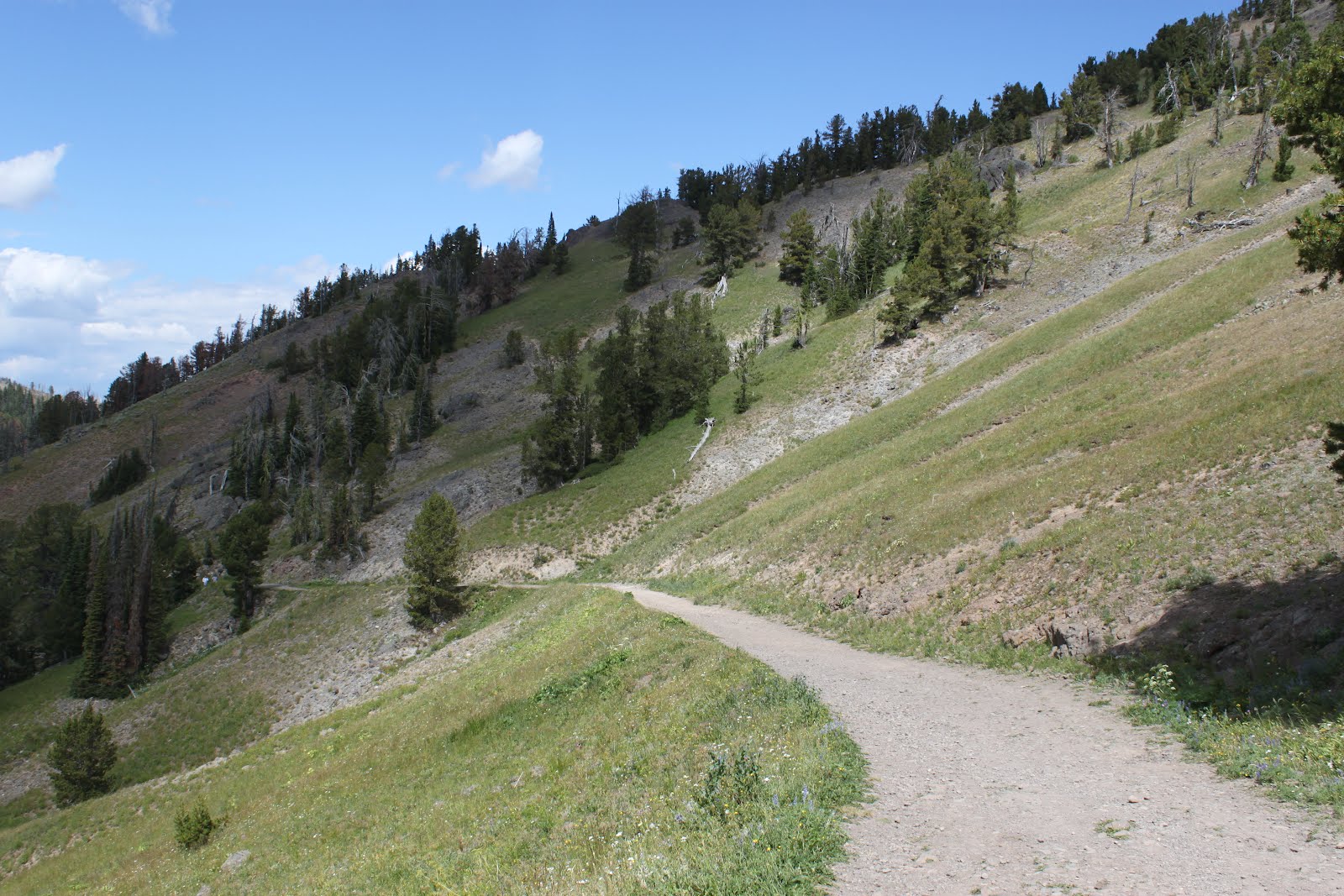 "Heavy grizzly bear activity?!" Now they tell me.
Sunday, March 25, 2012
Change of Plans
I was supposed to go to Dave and Rick's Charlotte Comic Convention today, but I had family stuff take front and center and I had to go elsewhere. As it was, I ended up in Huntersville for the day. There are worse spots to get stuck, I reckon.
 Carole's mom's house.
 Carole's late father planted amazing beds of azaleas around their property. Hanging out there in Spring is pure pleasure for the eyes.

 Carole's mom's house.
 Carole's late father planted amazing beds of azaleas around their property. Hanging out there in Spring is pure pleasure for the eyes.
This is where we keep our Casita trailer. The dogwoods help to show it off.
Saturday, March 24, 2012
More Yellowstone Memories.
Yellowstone's wildlife is amazing. It's everywhere. The only place I've visited where there is more wildlife on display acre-for-acre is Florida. Everywhere we drove and everywhere I hiked I encountered all sorts of animals. They call in "America's Serengeti", and I suppose that's true. And with the return of the wolf to the Park, we have our chief top predator back in the mix.
Wolves were about the only thing we never saw when we were in the Park. We did visit Lamar Valley, where sightings of wolves is most common, but we never did see one. The closest we came to seeing a wolf was a coyote--and that was a young, shy one who hid behind a big evergreen tree and wouldn't come out where I could take a good photo.
My main goal was to see a grizzly bear while we were in Yellowstone. And I saw two of them. Both were from a distance, and one was fast asleep. He was taking a nap along the collapsed banks of the Lamar River. I took his photo from a very great distance, which is the way I always want to see a grizzly bear.
 If you look in the center of this photo, you can see the griz asleep in the dirt.
 Here's the cropped version of the photo with the sleeping bear.
 The true emblem of the faded Pleistocene: the American bison.
 I expected to see a lot of pronghorn, but we saw very few of them in Yellowstone. This one, like the griz above, was in the Lamar Valley.
 When I go back to Yellowstone, I hope to spend most of the time in the Lamar Valley. It was, to me, the prettiest part of the Park. It was also the least crowded with humans.
 There was a trail leading to the top of this peak. I plan to hike it when I return.
 To illustrate how fragile the thermal features are in the Park, here is a geyser that was active in the early history of the Park, but which is now cold and dormant.
 It took this panorama from the high ridges of a 10K-foot peak (Mount Washburn). It's the Grand Canyon of the Yellowstone seen from thousands of feet above the rim of the canyon. The air was hazy in that part of the Park that day because of some forest fires (that quickly faded out by the next day).
Thursday, March 22, 2012
Tower Falls Area
When we took our big vacation to Yellowstone in 2010, some days we packed as much into 24 hours as we possibly could. Every morning we'd get up at dawn and go until we were exhausted. Every night we'd all collapse into bed and fall immediately to sleep to get ready for the next day.
One especially full day was spent around the Tower Falls area. That was the day we took a soak in the hot spring along the Gardiner River. But later we headed out for all kinds of sight-seeing and hiking. Here's just a small portion of the stuff we saw that day:
 Tower Falls from one of the overlooks.
 Heck with it, I figured. I'm hiking down there!
 You can really see the soft stuff that makes up much of the underlying material in Yellowstone. It's obvious that the place was just a huge caldera full of exploded rock and dust. The rivers cut through it like it's soft chalk. Which, basically, it almost is.
 I enjoyed this hike to the river. It was peaceful down in the gorge--almost no other people were there. All I had to do was hike back up. Of course that wasn't nearly as tough a hike as climbing out of Linville Gorge.
 Later, we traveled to a hot springs area that had some petrified trees. A number of them were standing as they must have been when volcanic ash covered them. They had this one fenced off to keep souvenir hunters from carrying it away, piece by piece.
 And after that, we toured a tremendous thermal area with all sorts of bubbling springs and roaring formations screaming thunder and steam.
Wednesday, March 21, 2012
Rugged Territory
Another brief post for today.
One of my favorite spots in North Carolina is the Linville Gorge Wilderness Area. It's true wilderness and very rugged. About as rugged as terrain gets in the eastern side of North America. The gorge is over 2,000 feet deep in some places, and it's easy to understand why people get lost in there even though all you have to do to get out is either follow the river upstream or down, or climb either side of the gorge (avoiding the cliffs, of course). Still, people get lost in there all of the time. People get killt down there, too.
 These are the cliffs of Shortoff Mountain. "Shortoff" is the English corruption of the Slavic name Shortov, or Chortkov. There are a lot of mountains in the southern Appalachians called "Shortoff Mountain". There were apparently some Slavic people passing through the region at some time or another--enough of them to leave names behind.
This Shortoff Mountain is probably the most spectacular of them. It has tremendous cliff bands, and some really scary chasms.
 And here I am a couple of winters ago, actually on Shortoff Mountain on the opposite side of the gorge from where I took the first photo. This was on one of the best hikes I ever took into the Gorge, with my pals Andy Kunkle and Jack Thyen. This photo was taken with my little Canon A1100IS camera by Andy (I think Andy took it).
Tuesday, March 20, 2012
Hot Springs and Cold Falls
It was back in 2004 that I got serious about getting out into the wilderness areas, state parks, and National Forests and Parks again. I'd been too busy for too many years doing other things and it had become a rare day for me to go hiking or camping or backpacking. Since then, I've been pretty busy in the outdoors, but now the writing business has been keeping me far too busy to go into the fresh air the way I need to do.
Having what amounts to two jobs has become quite a burden. I can't quit the day-job just now, so I'm going to have to cut back on the amount of time I spend writing. There's nothing else for it, because I stay physically and mentally exhausted working on novels, short stories, and doing my utmost to meet deadlines. I have some publishing commitments to keep, but after that I'm going to cut back on my writing. If I don't, I'll probably drop dead from the pressure.
Following are some photographs from a hike I took in 2004 when I first started back into that. I love hiking. I find the solitude soothing. Being away from the sounds of other people, and far away from the constant grind and roar of machines is something that I have to do from time to time. The more often I can do it, the better.
The first six photos were taken in June 2004 in Holly River State Park in West Virginia. This park is especially pretty, and I'd love to go back for a visit. Carole and I tried to do that this past Fall, but there was some kind of horrible gathering taking place there so that when we arrived the park was packed to capacity and beyond. It was horrid. We might as well have been in Times Square! We ended up heading over to Kumbrabow State Forest where we indeed found some solitude and quiet, if not quite the level of natural beauty.
 This is the top of a waterfall known as Shupe's Chute. So designated because the entire contents of the North Fork of the Holly River gets squeezed through a rock channel that's so narrow you can actually jump across it.
 The picturesque Chute, itself. The day I was there, the water levels were way up and the noise from Shupe's Chute was deafening.
 The water from the Chute has ground and sliced its way through this very hard and durable rock. You can physically feel the power of the water from a distance as it slams its way down the mountain.
 The bottom of the Chute where it empties into a huge swimming hole.
 The pool at the base of the Chute almost begs for you to go swimming. The week Carole and I were there, although it was early June, was far too cold for swimming. The days were overcast with almost constant rain, and the temperature never cracked 60 degrees.
 This waterfall was along the Holly River above Shupe's Chute. There was so much water in the mountains while we were there that we saw waterfalls where there might likely only be such every ten years or so.
 And a much more recent photograph taken by my son, Andy, of me and Carole on the Gardiner River in Yellowstone National Park. This is a spot where you can mix the water from a hot spring with the frigid waters of the Gardiner River and create a nice pool of warm water for soaking.
Subscribe to:
Posts (Atom)