Finally, I made my way down to Longbottom Road and began to trek toward the trailhead. But I managed to pass it by about three miles and had to turn around. By the time I got to the parking area it was almost 10:30.
According to the map and directions I had the hike looked to be about 4.5 miles each way with about 1600 feet of elevation gain. One descriptor I read said that there were seven creek crossings. I ended up discovering, though, that all mileages were off by at least a mile each way; and there were, in fact seventeen creek crossings! Seventeen! Add to this the fact that the humidity levels were off the scale and I ended up being put through the wringer on this hike. It was horrible!
The first 1.7 miles or so is on the Grassy Gap Fire Road which apparently is a jeep road that has been used for fire suppression and to get equipment farther into the forest for trail maintenance. It's a slow, steady, easy climb along Basin Creek. This is all National Park property. It forms a big pie shaped wedge of land from the Blue Ridge Parkway down to the parking area on Longbottom Road. There are over thirty miles of trails on over 7,000 acres of land. Most people see only the part of the Park directly adjacent to the Parkway. But most of it is very different from these open meadows and it is, in fact, very heavily forested by recovering stands of hardwoods and white pines. This is what you hike through as you leave Longbottom Road and head up toward Caudill Cabin.
I was extremely impressed with the forests here. They are not composed of vast, ancient trees, but they are still imposing. Some of the stands of white pines are rather grand, but it is the groves of various hardwood species that are the most stirring.
All of the two trails that I used to access the Caudill Cabin site are adjacent to rushing streams. But it is when you reach Basin Creek that you find yourself in classic, southern Appalachian landscape. Trees tower over you, rhododendron blossoms are all around, rocks abound, and the sound of water crashing against polished stone is everywhere. This is indicative of the great blue wall of the mountains that rise up from the Piedmont so abruptly here in my native South.
The climb to the cabin was pleasant in many ways, but I'd be lying if I said it wasn't difficult for me. The route is steep, and the seventeen creek crossing took a toll on me whenever I'd encounter one that was too deep to rock-hop and had to take the time to remove my boots and socks and then put them back on once I'd reached the opposite shore. In high heat and humidity, minor things like that take a toll. By the time I got to my destination I was as drenched as if I'd been doused by gallons of water, but it was all sweat that had soaked through my clothes. Yeah, it was pretty miserable in that respect.
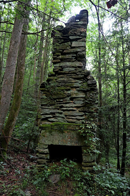
As you climb you pass through what had once been the old Basin Creek community. Not quite a town, it still held a population of farmers who lived along the banks of the creek, farming the land and earning livings enough to support large families. That all came to an abrupt end one day in 1916 when a flood came roaring down the tributary washing away most of the houses and killing most of the people who had lived there. The community never recovered and in the 1930s the National Park Service purchased this large plot of land that is now Doughton Park.
The principle reason I went to hike there was to see the historic Caudill Cabin, the last remaining structure from the days just before the flood. But I also went to enjoy some solitude while I hiked, which has been missing from most of the outdoor trips I have taken recently. And it paid off. I did encounter one group of ladies who were coming down the mountain just as I was passing a large waterfall, and they asked me to take a group photo of them with their phone cameras (which I was happy to do).
Even though the hike did me in, I had a great time, suffered some hamstring cramps when I got home, but physically did okay compared to what I suffered through from some other more recent trips tromping up and down the steep slopes of the southern Appalachians.
 |
| This is the only part of the buildings at Doughton Park that is still being used as a visitors center. It was closed when I got there. |
 |
| Typical groomed lawn along the Parkway. |
 |
| Basin Creek as I hiked along. |
 |
| Rhododendron in full bloom. |
 |
| The following few photos are the ruins of farms that once lined the creek. Many were killed in the 1916 flood. |
 |
| The waterfall where I met the nice ladies hiking down the mountain. |
 |
| My initial view of the Caudill Cabin as I emerged from the deep forest. |
 |
| This one-room cabin once served as home for an entire family. |
I travel to the cabin.


No comments:
Post a Comment