I don’t like cities. I never have. I live in a city, but viewing the photos I’ve taken over the past few years, I realized that I took very damned few inside cities. This is largely because I tend to avoid cities when I travel, choosing to go to places as far away from urban areas as I can possibly go.
The fact that I don’t care for cities (of any size) came to me as I went through my catalog of photographs from my many vacations since I bought my first digital camera in early 2004.
The following are a few of the very limited number of photos that I’ve taken in cities since that time. Cities don’t inspire me. Most likely because I generally can’t tolerate crowds of lowing humans.
Bah, Humbug! Helvetia, West Virginia. Yes, stretching the term "city", I know.
 Part of the hideous shithole known as Hilton Head, South Carolina. I vow never to return to that overcrowded wasteland of sandy garbage.
 Inside the Mellow Mushroom pizza restaurant in downtown Asheville, NC (a city I can tolerate).
 Downtown Asheville, NC as a light rain changes over to light snow.
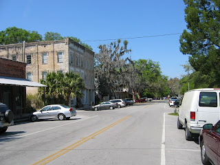 A small city we passed through in central Florida. I forget its name. It was okay and I didn't want to burn it down.
 Saluda, North Carolina. A nice little town. It doesn't suck ass.
 Nighttime at Reedy Creek Park in downtown Greenville, SC. Definitely a city that has a lot of charm.
 In the Mast General Store in downtown Boone, NC. The city is far too crowded, but it doesn't completely suck.
 Mystery city somewhere in the mountains of North Carolina. I can't recall where I was when I took this shot. Not that I give a rat's ass.
 A place somewhere in Florida. Far too crowded, and it sucked, but I took this photo on the beach.
 In downtown Key West, Florida. I liked Key West and will go back there.
 Saint Augustine, Florida. It has streets where no cars are allowed. I like that.
 Freeport, Maine. It's an okay place. The North Face outlet store is worth the trip.
 Downtown Gatlinburg, Tennesse. A true human cesspool.
 Once again, downtown Gatlinburg, Tenessee. I have no idea what this means.

 When my family and I got ready for our last vacation of 2007, I thought that I would have the opportunity to bushwhack to the summit of Mount Mingus and finally bag that peak. However, the day we arrived in the park, November 15, we found ourselves in the midst of a major winter storm. I had not come prepared for hiking on ice, which was coating the ground, along with heavy snow. Driving up to Newfound Gap, from which I had hoped to hike to Mingus, we found ourselves in driving snow, high winds, icy surfaces, and very cold conditions. In addition, not long after we got to Newfound Gap, the Park Service chose to close 441 so that my family could not drive back up to get me even if I had been prepared for hiking on ice. So I made the decision to head back down to our campsite at Elkmont Campground.
Near Newfound Gap in the snow Not long after leaving the gap, we found ourselves stuck in a line of traffic while the Park Service blocked the road so that they could turn back everyone who had been heading up the mountain from Gatlinburg. This took well over two hours, but we 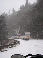 didn’t complain, as it gave us time to sit and enjoy the snowstorm and the piling white. When the signal was given to proceed, we just put the truck into four-wheel drive and headed back to our travel trailer at Elkmont. With the day shot, (it was dark by the time we got back to Elkmont), I took out my topo map to figure out which peak I would bag for this last trip of the season. Since the trailheads to the higher peaks via 441 were off limits (the road was closed for the next 48 hours), I looked to see what I could bag from the Elkmont Campground. Soon, I realized the best mountain to hit would be Dripping Spring Mountain, a 4801-foot summit just to the west of the spine of the Great Smoky Mountains. It looked to me to be a good candidate for some nice views of the peaks in that section of the park, providing there was some open ground near the summit. The storm that had closed the road and covered the high country with ice and snow was relatively short-lived, and by morning the skies were clear, even if the roads were closed. I’d promised my wife to drive her to Pigeon Forge that day, so a long
 hike was out of the question. But I gathered my day-hiking gear and got it ready for a Saturday hike. In the meantime, we drove into Gatlinburg and Pigeon Forge and came back to the park for some easy hikes near Elkmont (including Laurel Falls). Early the following morning I was chomping at the bit to bag Dripping Spring Mountain. The route I chose was to take the Jakes Creek Trail to Jakes Gap and then the Lyn Camp Prong Trail toward the AT, but stopping short of the AT to bag Dripping Spring Mountain for a round trip of about ten miles and a total elevation gain of roughly 3,000 feet. At the start, the trail is a very wide and well-maintained roadbed. It appears that the Park Service must still use this as a road for jeeps from time to time. It remains a very wide, groomed gravel road until you reach a point where you have to ford Jakes Creek via a classic Smokies footbridge. Along the way, one passes a number of small waterfalls, including one that has a tremendously fine swimming hole that I have to be sure to use when the weather is warm. The trail tackles the mountain at a fairly steady but easy grade. One can glimpse both Blanket Mountain on the right and the back of Dripping Spring Mountain on the left as you ascend. The forest here are classic cove hardwoods, and the hemlocks are pretty much completely dead, so what few evergreens one encounters are mainly pines. Backcountry campsite #27 is along the trail and seems to be a good place to set up a tent. Wide and spacious with a big climbing rock, fire ring, and bear cables. At Jakes Gap I took the left-hand trail toward Dripping Spring Mountain and continued to head up, knowing that I had the lion’s share of the climb behind me.
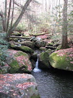 From here, I only had about eight hundred vertical feet to the summit, and less than two miles to go. The forest type changes a bit here and has a large hemlock component, although that’s moot at this point, as they’re all dead or breathing their last. The forest is going to be very open and sunny in the coming
 years as all of these grand old trees die off and fall over. It’s the chestnut blight all over again, it seems. By noon I found myself very near the summit of the mountain. The trail is obviously a popular one, linking up with the AT as it does, and shows the effects of heavy use by both hikers and horseback riders. Just as I was getting ready to take a look at my map and get a GPS reading, I came out of the forest onto a very open area of stunted trees and low-growing rhododendron. The views toward the spine of the park and Thunderhead were spectacular. I could also see the true summit and a manway leading in that direction, so I followed it up. Just about twenty or so vertical feet shy of the mountaintop, the
 manway vanishes and you have to bushwhack through some very thick rhododendron to get to the very top. If you choose to do this, it’s best to leave your pack and pick your way carefully through the hell to the true summit, from which there really aren’t any views. After bagging the summit, I sat down in a small grassy area to enjoy the views and
 eat a small lunch of crackers and water. I just took it easy, snapped a lot of photos, and relaxed as I took in the scenery from a true grandstand of the Great Smoky Mountains. By 12:30 or so I was ready to head back down to my family, backtracking along the same route I’d taken to the top and making it back to Elkmont at around 2:15.Add to My Profile
|
More Videos
I stumbled upon this small waterfall and pool as I was hiking to the summit of Dripping Spring Mountain. I need to return to this spot in warmer weather for a swim.
We returned to the Smokies for a four-day vacation, staying at Elkmont Campground. Details later. For now, just a couple of shots:
 Me and my son at Laurel Falls.
 I'd suspected that the views from the summit of Dripping Springs Mountain were impressive. I wasn't disappointed.
When I was in my twenties, I met a young man named Jason Brock who went on to work for me in the comic shop that I owned in Charlotte, NC. Jason was extremely intelligent and quite talented, and when we lost touch I used to wonder how he was doing, what employment he found as he got older, and, later, why he wasn't famous yet.
 Jason in the midst of imitating a certain sf author.
Years passed and Jason got in touch with me via the internet. He was living between Oregon and California, owned two houses, was married, had a great consulting job in computer technology, and made documentary films. I wasn't surprised.
 William F. Nolan is in da house! YOW!
This week, he drove into town along with one of the all-time great fantasists of the past century, William F. Nolan, a great friend of Jason and his wife, Sunni. We spent this past evening (November 13, 2007) talking and enjoying a meal and talking some more. Nolan, in addition to being one of our great writers of fantastic fiction, is also a phenomenal mimic, and he had me rolling with his imitations of Burl Ives, Humphrey Bogart, Sidney Greenstreet, Peter Lorre, Walter Brennan, Ray Bradbury, etc. I was laughing so much that I plumb forgot to ask him much about the nuts and bolts of writing. Alas!
 He let me call him "Bill"!
I was sad to see them head on, but I hope to see them all again someday soon. Jason and Sunni have some new projects coming together that I'm waiting to see completed. And the next time I sit down with "Bill" Nolan, I'll remember to ask him about his writing techniques. (If I'm not laughing too hard.)
 Nolan, Jason & Sunni Brock take their leave of the Smith House on their way to the Big Apple.
I made my first visit to the Great Smoky Mountains National Park at the age of 15. In fact, I entered it at the age of 15, and two days later had my sixteenth birthday at the Laurel Gap Shelter deep in the Smokies backcountry. It was June 28, 1973, and ice had formed in my water bottles overnight.
The Great Smoky Mountains National Park was formed when this nation was in the grips of the horrible Great Depression. I doubt that the will to create such a national park out of forest lands and developed communities could be done today. Perhaps we need another Great Depression to spur us to preserve that which should be preserved and do away with that which need not be saved.
In the 34 years since my first visit there, I have returned many times. Not as many times as I would wish, but quite a few. I've hiked into almost every quadrant of the Park and seen things that I wish everyone could see at least once. Just five years ago I embarked on a personal mission to view the old growth hemlock groves before they became extinct. This I did, and now most of those groves are standing as dead and soon-to-be-weathered husks where once all was green. Another crime to add to the list of offenses by Mankind.
Following are just some of the things I have seen in my many hikes into the Great Smoky Mountains National Park.
 Fifteen-year-old me on my first visit, swimming at Midnight Hole on Big Creek.
 Midnight Hole, 2006, with a kayaker going over the falls.
 Laurel Gap Shelter. That's me inside, the morning of my sixteenth birthday, June 28, 1973.
 The backcountry where Laurel Gap Shelter stands, just below the summit of Big Cataloochee Mountain.
 In an old growth hemlock grove, 2004. Those hemlocks are all dead, now. I had to see them before they died.
 Inside an old poplar, 2004. Mother Nature.
 Alone on Charlies Bunion, 2004.
 In the overwhelming green of the Albright Grove, 2004.
 In Cades Cove, 2004.
 The definitive peak of the Smokies, Mount LeConte.
 The Chimney Tops.
 The Chimney Tops, up close and personal.
(More Smokies tomorrow.)
I blame Kerouac.
Mid-life crisis? I don't know. All I can tell you is that in my late 40s I finally discovered the work of Jack Kerouac and The Beats. It wasn't that I hadn't been exposed to them, but whenever I'd start to read ON THE ROAD or any of the other major Kerouac novels, the work would leave me cold and I'd quickly lose interest. Why? Hell if I know! Most people discover his fiction when they're in their teens or early 20s and it all clicks and they get a big dose of his wandering spirit and then they move on. But not me. It took decades before I knew enough to appreciate the poetry of his work.
So.
I have to blame Kerouac for getting me back into the life of wandering the hills as I had when I was a kid. Decades passed while I was married and worked various drudge jobs and raised a son and wrote short stories (that sold) and novels (that did not) and managed to avoid going backpacking. Soon after my son hit his mid-teens I gave ON THE ROAD another shot, and everything fell into place. And then it was THE DHARMA BUMS and I recalled just why it was I used to live so many nights a year sleeping under the stars.
The woods called me back.

It had been some months since my return to the hiking/backpacking scene when I decided to bag some of our highest peaks here in North Carolina. The best place to hit a number of peaks in excess of 6,000 feet (what we call our "sixers") was along the Black Mountain Crest Trail that leads from Mount Mitchell down to Bolens Creek. At about twelve miles, it was more than I had time for since I'd have to do it round-trip style and that was a grand total of 24 miles. Too many miles to pack into what I knew would be a relatively short hiking day. So I scheduled to leave from the summit of Mitchell and hike half the trail to Winter Star, making for a twelve-mile round trip hike. Well within my schedule and abilities.
The day I'd chosen, November 11, 2004, was a spectacular one for day-hiking. It was unseasonably warm and the skies were clear and almost cloudless. I'd gotten a later start that I wanted, but I managed to get to the peak of the Mitchell by 10:00 am rather than the 9:00 am I was hoping for. In quick order I parked my truck, shouldered my daypack, and started down the trail.
I knew that the Black Mountain Crest Trail had a reputation for being one of the toughest in the Southeastern USA. So I was mentally prepared for a long day of physical exertion. I was not prepared for the sheer beauty of the trail, though. It far exceeded my expectations and I kept coming to one vast scene of beauty after another as I hiked over rocky summits and passed along cliffs and walked down into deep gaps dark with balsam trees. Very early into the hike as I walked briskly along, I startled a black bear that plunged off the trail before me and ran at great speed into the forests to escape our encounter. I'd obviously startled him far more than he'd surprised me, and I was disappointed that I hadn't had time to get a photo of him.

Stopping repeatedly to set up my tripod, I took well over 100 photographs as I hiked over Mount Craig, and Big Tom, and Cattail Peak, and Potato Hill, Balsam Cone, and Winter Star. Each of these peaks is separated from the next by a deep gap into which the trail plunges and one must climb steeply to the next to achieve the summit. I was having so much fun and was so impressed by the beauty of the trail (which I had all to myself, as I encountered not a single other hiker), I didn't have time to wonder about being tired.

In a few hours I was standing in Deep Gap and looking up at the romantically named mountain, Winter Star, which I soon climbed, standing on the summit and looking north toward the half of the trail I didn't have time to hike. After taking a few photos, I headed back toward Mount Mitchell and my waiting truck.
My wife insists that I always take everything with me when I go off hiking on my own. Everything that I might need in case of an emergency. A whistle. Warm clothing. Waterproof matches. Extra water. Compass. Map. And on and on. As I was heading out of Deep Gap and back up the mysteriously named Potato Hill (it's one of the biggest and baddest mountains in the eastern USA, so why it would be called "Hill" is beyond me), I realized that I hadn't brought enough water. As I topped the mountain I finished off the last swig in my last water bottle. I pushed on.

It was soon after this that the cramps hit me.
The pain in my thighs was almost heart-stopping. The tendons from my knees to my groin seemed to freeze up and I was stopped in my tracks. As I stood there grimacing in pain and unable to move or take a single step, I was wondering if I was suffering from the altitude, for the entire trail lies well over a mile above sea level, and most of that being at, or above, 6,000 feet. It was only later, after talking to a physician, that I found that what had happened was that I had sweated out a lot of minerals and my body was punishing me for that. What I needed was some salt and some potassium, but at the time I didn't know that, and didn't have either at any rate.
So I rested there in the dark, balsam woods waiting for the pain to abate enough so that I could continue. The sun was beginning to set and I still had several miles to go to get back to my truck. The thought of being stuck on this tough trail in the dark was most unappealing.
As soon as the pain subsided, I began to hike again. Within a few yards the cramps came back, with a vengeance, and I was stopped yet again on the steep, rocky slopes of Big Tom Mountain. The Black Mountain Crest Trail was not going to let me get back to my truck without a struggle, it seemed. All I could do was stand there and let the cramps fade and try again.

This went on, time and again, as I hiked the extremely steep slopes (sometimes needing all four limbs to continue onward), achieving peaks and then dropping down again into plunging gaps before tackling the following mountain. I was worried that I wouldn't make it back to my truck before nightfall. In addition to the idea of hiking in the dark (I had a headlamp in my pack, which allieved some of that worry), I knew that the Park Service closed and locked the gates at nightfall, so I'd be locked in if I didn't get out in time.
By the time I reached Mount Craig, with its exposed summit and looming cliff faces, I could see Mount Mitchell. The skies were ruddy with the fading sun and I knew that I still had more than a mile to hike and the cramps kept attacking my legs at frustrating intervals. The thought of the full water bottles that awaited me at my truck kept me pushing on. In the hollow between Mount Craig and Mount Mitchell, the sun was having a hard time reaching into the dark balsam woods. It was easy to realize why this range is called The Black Mountains. But I knew that I was almost home free.

In the last of the fading light, I finally came out of the forest and reached the parking lot below the summit of Mount Mitchell. I opened the door and grabbed first one, and then a second bottle of water and guzzled them. The cramps begant o subside as I got some moisture back into my body. Going to the bathhouse at the mountaintop, I changed into some clean clothes, then went back to my truck and headed down into Asheville for a meal and the long drive back home.
Since that trip, I've added a few things to the kit that I take with me when I hike:
aspirin and vitamin tablets.

On one of my subsequent visits to Panthertown, I spent three days and two nights totally alone in the valley camping, hiking, and exploring the maze of trails. It was late September, just after the remnants of a hurricane had dropped untold volumes of water over the North Carolina high country and the Valley was posted as "closed" due to high water and wind damage. However, a ranger had told me that the closure was lifted and it was okay to venture in. But no one took down the closure signs and so I had the place to myself for the duration. Just me and the coyotes who would come down to my campsite every evening between 7:00 pm and 7:15 pm and serenade me with their eerie music.
One thing about Panthertown Valley is that there is no official trail system there. The only trails were hacked in by various folk over the years and some were maintained by a local until he got too old to continue. So you have to be sure to get the GUIDE'S GUIDE TO PANTHERTOWN VALLEY before you go tramping about in there. Without that map, it's almost certain that you'll get lost in the huge numbers of criss-crossing trails made by wandering hikers, hunters, fishermen, deer, bears, etc.
 This was one of the side trails that I happened upon while heading toward Shelton Pisgah Mountain. I wandered down it a distance before heading back up. It dead-ended at a dropoff above a stream. Bear trail? Not sure. I had to hunker down to maneuver through it.
 I always like to bag new peaks when I'm hiking, and there were lots of new mountains I hadn't hiked in the ring of ridges that form the sides of Panthertown. This was my self-portrait taken on the event horizon on the cliffs of Blackrock Mountain.
 Some of the debris I had to maneuver around. Trees knocked over by wind and water were all over the Valley on that trip.
 The weather, a closure sign, and circumstances allowed me to have Panthertown Valley all to myself for three days. It'll never happen again, I'm sure.
 One of the many fords I had to make as I tramped around the Valley.
 I found this pool down in the area known as "Devil's Elbow". As the temperatures had risen considerably (it was October 1st), and I was tired and sweaty from all my hiking, I chose this place to take a quick dip.
 Yet another of the dark tunnels leading Bog knows where. I crawled down this one until I heard rapids crashing below me.
 A view of the Valley from near Salt Rock Gap. From here, you can see the scar of the right-of-way that Duke Power raped through the forests. Thanks a lot, Coroporate Assholes!
 The southwestern corner of North Carolina is rich with natural history. It's a world of tortured terrain consisting of mile-high peaks and plunging valleys, untold numbers of waterfalls, rushing mountain streams, looming granite walls of exposed rock, a rich growth of plants and trees that rival the Great Smoky Mountains, and all of it nearly ruined and wrecked by rampant development, urban sprawl, and the ever-present stench of Mankind's destructive ways.
On August 19, 2004 I made my first visit to a tiny bit of this part of North Carolina that is relatively undisturbed by the suburban sprawl that is eating away at this land like a runaway cancer. Several thousand acres had somehow lain unpurchased by developers--a vast U-shaped high elevation valley full of rocky peaks, deep forests recovering from the turn-of-the-century rape by logging companies, but in a near-wild state. There were moves afoot to get these several thousands of acres into a wilderness designation and into public hands. But the Duke Power Company, with its bottomless pockets, stepped in and grabbed Panthertown so that the corporation could slash a powerline right-of-way down the very center of the valley. After they had done this, they "generously" handed over the remaining halves to the National Forest system as a supposed gesture of good corporate citizenship. They even got a lot of mileage out of this trickery as if they'd done a good deed.
If one can try to ignore the horrid slash down the middle of Panthertown, it remains a place of startling beauty. After you drive past the sprawling high-income subdivisions and the estates of multi-millionaires standing out like sores all over the slopes and atop the ridgelines, you can park along a Forest Service Road and stroll into this tiny remnant of wilderness.
On my first trip into Panthertown, I saw just why it is so admired by so many. Plutons lift up from the level valley floor and offer amazing views from their rocky summits. Waterfalls seem to be hidden around every bend in every stream. In the deep valleys, the air is alive with the sound of rushing water. The forests are not old, but are green and beautiful nonetheless. If you know where to look, it's not hard to find bear tracks, and at night you can be serenaded by the coyotes that have taken up residence there.
I spent that first day hiking over and around Little Green Mountain, discovering various waterfalls, and swimming in the cold pools at the base of Schoolhouse Falls. I pretty much fell in love with the place, but don't visit it as often as I likely would, for it's painful to see the inexorable ringing in of the valley by the constant crush of subdivisions that will inevitably close it in, making of it nothing more than a pathetic urban park. Near the summit of Little Green Mountain the fragile mosses are intact and untrampled.
 Lichens, mosses, grasses, and water conspire to reduce the mountain to a plain.
 Greenery and stone and this old stump combined to create a pattern that I chanced upon. The last time I visited this spot, the stump was gone, likely burned in the campfire of some moron.
 Schoolhouse Falls. Even on the hot August afternoon, I found the waters in this great pool to be among the coldest in which I've ever been swimming.
 Helvetia, West Virginia. Yes, stretching the term "city", I know.
 Part of the hideous shithole known as Hilton Head, South Carolina. I vow never to return to that overcrowded wasteland of sandy garbage.
 Inside the Mellow Mushroom pizza restaurant in downtown Asheville, NC (a city I can tolerate).
 Downtown Asheville, NC as a light rain changes over to light snow.
 A small city we passed through in central Florida. I forget its name. It was okay and I didn't want to burn it down.
 Saluda, North Carolina. A nice little town. It doesn't suck ass.
 Nighttime at Reedy Creek Park in downtown Greenville, SC. Definitely a city that has a lot of charm.
 In the Mast General Store in downtown Boone, NC. The city is far too crowded, but it doesn't completely suck.
 Mystery city somewhere in the mountains of North Carolina. I can't recall where I was when I took this shot. Not that I give a rat's ass.
 A place somewhere in Florida. Far too crowded, and it sucked, but I took this photo on the beach.
 In downtown Key West, Florida. I liked Key West and will go back there.
 Saint Augustine, Florida. It has streets where no cars are allowed. I like that.
 Freeport, Maine. It's an okay place. The North Face outlet store is worth the trip.
 Downtown Gatlinburg, Tennesse. A true human cesspool.
 Once again, downtown Gatlinburg, Tenessee. I have no idea what this means.


