Showing posts with label Sherando Lake Recreation Area. Show all posts

Tuesday, June 21, 2016

THE TROUBLE BOYS

I'm already busy on the next book in the series. Tentative title for now is THE TROUBLE BOYS. In the meantime, here are few more videos I made of various hikes I've been on and waterfalls I've seen.

Later!


Looking up at "the Attic Window" from the time I hiked inside of a mountain.


Saturday, August 02, 2014

Up! Up! And Away!

Carole and I are headed to the high country at the Virginia/West Virginia line. To a part of the Appalachian mountains where we've never been. There really aren't a lot of regions in southern Appalachia that we haven't seen, now. So we're coloring in another blank spot on that particular map.

The area where we're headed has lots of waterfalls, mountain peaks, and lakes. We're taking the kayaks along. I will also--barring any unforeseen problems--finally visit the biggest thermal springs in the eastern USA. Look for many photos when I return.

So no updates to the blog for a bit more than a week.


None of these places are where we're headed, but are in the Virginia high country.

Sunday, June 29, 2014

Dreaming of Old Hikes.

Thinking of old hikes in beautiful places.

Rocky Mountain National Park, Estes Park, CO.

Long's Peak, Rocky Mountain NP, Colorado.

The Maroon Bells, Colorado.

Mount Sneffels Wilderness, Colorado.

Sherando Lake Recreation Area, Virginia.

Wilson Creek, NC.

The Black Mountains, NC.

Pisgah National Forest, NC.

Nantahala National Forest, NC.

Cullasaja Gorge, NC.

Thursday, May 31, 2012

More Work by the CCC


Once again--as if I needed to be reminded--we were faced with how much we owe to the works of the old Civilian Conservation Corps. The Sherando Lake Recreation Area where we spent a full day of enjoying ourselves under a clear blue sky is itself the product of the labor of the CCC. You can't stand anywhere in this recreation area without witnessing the results of their work.

There are two lakes here, both dammed and created by the CCC. There are a number of structures, one of which is absolutely spectacular and which was built by the Corps. It serves as a bathhouse, a picnic pavilion (with TWO huge fireplaces), a vending building, and a camp store selling ice, matches, and anything else you may have forgotten on your way to enjoying a cookout at the park.

What is always foremost in my mind when I see these places built by the CCC is that when they arrived here there probably wasn't much to see but the ruined lands denuded by timber companies. I doubt that there were many trees here more than a decade or so in age. The southern Appalachians were pretty much totally denuded of forest cover by the 1930s, and I will assume this spot was no different. It wasn't just to build lakes and campgrounds that the CCC busied themselves. They were also instrumental in laying the groundwork for the restoration of our native forests that had been so terribly ruined by the timber companies.

The main bathhouse, built by the CCC.
 

Trees, buildings, facilities, brought to you by the sweat of the CCC.

Two enormous fireplaces in the pavilion.

Carole under the pavilion. Look at that floor!

This guy had a really neat pontoon boat, complete with electric trolling motor.

Bottom of the spillway. The creek below here is a stocked trout stream.

Staircase leading up the spillway to the top of the dam.

Water going over the top of the spillway.

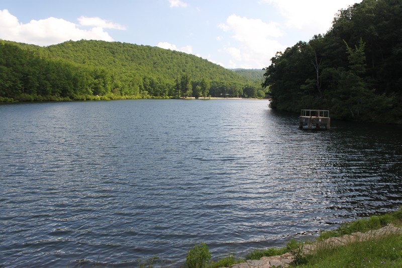
I forgot to take a good photo of the dams in the recreation area. But I did manage to remember to take a shot from atop the dam looking out on the lake.

I took this one mainly to illustrate the detailed and meticulous rock work on the retaining walls.


Wednesday, May 30, 2012

Sherando Lake Recreation Area

 Carole and I took a short vacation to northwest Virginia. She wanted us to see a spot called Sherando Lake Recreation Area. We're always looking for new places where we can take our travel trailer, and this National Forest site seemed to have the things we like in a campground and forest setting. But reading about it on the Internet and seeing it up close and in person are different experiences. So we opted to make the four-hour drive north to check the place out.

It actually ended up exceeding our expectations. The campground itself is very nice and some of the sites even have electric hookups. We like this option, as it means that we don't have to carry our generator along with us. In addition, each camping loop has bathrooms with hot showers, which is another thing we look for since it means we don't have to tap into our onboard water tank to use for our trailer's shower.

And, of course, the presence of a lake makes for a good place to go swimming, paddling, and fishing.

What I had no knowledge of at all before we arrived was the quality of the hiking trails around the lake. I needn't have worried about that, since there is an extensive system of trails that lead from the Recreation Area up to, and beyond, the nearby Blue Ridge Parkway. There are any number of trails one can use to create a vast combination of hikes of various lengths and levels of challenge.

After we ate lunch Carole went back to the lake to swim and I headed off to do a loop hike of about five miles. The hike I picked combine three different trails and a very brief road hike that would take me around the lake, up the heights of Torry Ridge, and back down to the lake. I was only expecting an average hike with average views, but I was rewarded with a loop that was far more spectacular than I had thought.

The trail follows the even terrain along the lake shore and then tackles the steep slopes of Torry Ridge. After a tough climb you come to the first overlook called, appropriately, Overlook Rock. This is a big quartzite cliff that affords a really impressive grandstand over the gorge and toward the high peaks surrounding the area. You look down from a considerable distance down on the lake.

After that, I headed on down the trail and came to the Torry Ridge junction and the high point of the hike. This spot was a forested spit of rock that was kind of neat, but I quickly headed on after making sure I'd hit the high point.Within about a half mile, though, I came to what I really wanted to see--a vast talus field that leads up from near the shores of the lake all the way to the top of the ridge. This talus field of shattered quartzite rock is impressive, and walking along it was a lot of fun.In addition,  it offered even better views than I'd seen from Overlook Rock.

From there I only expected a typical hike through second-growth forests back down to the lake but I was again surprised to find that the trail follows a very long cliff as it initially only slowly descends the mountain slopes. For about a mile one is rewarded with great views from pale quartzite spots along the trail before it finally begins to head down the mountain and into the valley.

My final surprise of the day was when I began to notice some vaguely familiar leaves in the forest around me. At first I barely noticed them, but then I realized that I was probably looking at American chestnut leaves. So I stopped to examine them more closely. Sure enough, I was pretty darned sure I had stumbled upon a patch of our native chestnuts. This isn't as rare as you would think, as the trees do occasionally pop up from root systems that have managed to survive over the decades since the chestnut blight killed off the vast chestnut-dominated forests of the Appalachians. But what did surprise me was how many of the trees that I was seeing. In quick order I counted a dozen or so of them, most of them less than ten feet tall. I have no doubt that this young grove will eventually succumb to the blight, but it was nice to see so many of them growing so thickly.


Sherando Lake Beach.

First good overlook.
Self-portrait standing at the big talus field.

Looking down from the talus field toward Sherando Lake far below.

Standing at the top of the talus field.
Great signage and infrastructure along the trails.
Along the line of cliffs on the way down.
Mushrooms.
American chestnut trees.
And the mountain laurel were in bloom.