Showing posts with label Mount LeConte. Show all posts

Thursday, August 12, 2021

My Hike to the Summit of Mount LeConte and My Stay at LeConte Lodge.

 The first time I saw LeConte Lodge was on a dayhike to the summit of Mount LeConte in 1974. I took the Alum Cave Trail to the top of the mountain and spotted the lodge as I hiked up to the Cliff Tops overlook. Of course I had to take a detour and see the lodge. It was amazing to me that comfortable accommodations were located high on the mountain many miles from the nearest road and with the only access being steep and rocky single-file trails.

Back then the lodge was still being heated with firewood. Later, when the owners of this concession were no longer allowed to gather firewood, they switched to kerosene heaters; and these days the buildings and rooms are warmed with propane heaters.

After I climbed to the cliffs to take some photos and look out over the nearby peaks, I went back for another look at the lodge. I wanted to be able to stay overnight there and stopped in the office to ask how that was done. And, of course, I promised myself that one day I would make the trip up there and stay for a night or two.

Decades passed and somehow I never got the chance to go back, except for dayhikes to the summit. Over those years I managed to find myself hiking up there seven different times via three different trails. When I started working for the USPS I would call and try to arrange a reservation, but on the days that I had free there were no spots open. To draw a long tale short I had to wait until I was retired; to a time when I could take an open date no matter when it fell. Thus, last month I called and asked about any cancellations and found two dates open in August.

I ended up taking the first open date even though Carole and I would be camping for four days in the same Park the previous week. We would be coming home, and I would be returning to the Park for my hike to the top of LeConte two days later. So it goes. I no longer live by much of a schedule. I make the plans and don't need to worry about job responsibilities.

For this trip I chose to go up via a trail called The Boulevard. At about 8.4 miles it's longer than the others I had used, but I had been told it was a lot easier than the three with which I was familiar. This proved to be a load of crap, as it is harder than any of the other three. For my money, the best way up is still Alum Cave Trail. You climb more, but the distance is a brief five miles, and the scenery is superior to any of the four routes I've taken.

But I made it up. The hike took me about five and a half hours since I stopped to eat breakfast on the trail (protein bars and water). I also paused many times to take photographs, as I always do when I go hiking. The first part of the hike is 2.7 miles on the Appalachian Trail with a climb from 5300 feet at Newfound Gap to 6,000 feet near the top of Mount Kephart. From there I faced a series of moderate ups and downs, losing and gaining elevation in what the hiking community refer to as "pointless ups and downs". At last, I approached more open territory with very rugged terrain and a steep climb of eight hundred vertical feet to the top of the mountain, then a drop of about two hundred feet to the lodge.

By the time I strolled up to the buildings I was quite tired and sweaty. I checked into my lodge room and soon discovered that my stay would be everything that I hoped it would be. I was pleased. I quickly retrieved a metal bucket to take water to my room and use a wash basin to take a sponge bath. Clean and refreshed, the first thing I did was crawl into my very comfortable bed and rest for about fifteen minutes. After that I took a stroll through the grounds taking photos, then went back to my lodge where I met a young couple from Detroit who were staying there for two nights.

Later I took a walk up to Cliff Tops but the views were obscured by passing clouds so there were no landscape photography opportunities. At 2 o'clock they opened the dining hall for various drinks and I had a couple of cups of lemonade. I then just sat on the covered porch in a rocking chair and enjoyed the passing clouds, some of them enveloping the lodge with fingers of white mist. Temperatures hovered around 64 all that afternoon, into the night, and were the same on the following morning.

Because of Covid the dining hall was closed except for brief trips in to get beverages, and then only masked. So the crew brings dinner and breakfast to your lodge room for the duration. The evening meal was roast beef, green beans, mashed potatoes, baked apples, cornbread, cake, and I had opted for three glasses of wine. I had plenty to eat and turned down offers of seconds when the staff made another pass.

Every other time I have backpacked into the Park backcountry I have had to sleep in a shelter or a tent, using a sleeping bag and hanging my food from a convenient tree to keep it safe from bears and other marauding critters. But that night I slept in a log lodge in a bedroom with a propane heater, on an extremely comfortable mattress between cottons sheets and under two wool blankets with a pair of soft pillows under my head. I slept deeply.

The following morning I rose, shaved, brushed my teeth, deposited the gray water behind the lodge and got ready for breakfast. They opened the dining hall and I retrieved several cups of coffee and soon had a great breakfast delivered: pancakes with sorghum syrup, grits, scrambled eggs, Canadian bacon, and a biscuit with plenty of apple butter. I ate it all and chased it with another cup of coffee. After that I got my pack ready as a rainstorm rolled in (the peak gets 85 inches of rainfall per year). I chose to wait a few minutes to see if the rainclouds would pass over, and they did. As the sun was revealed again I hoisted my pack and took a reluctant leave of LeConte Lodge. 

The hike down wasn't as difficult as the trudge up and I knocked it out in three and a half hours by making no stops at all and pausing only to take a few photos. I had wanted a two-night stay, and the next time I go I will be there for two nights. Because I will go back again. It's rare for an experience to be exactly what you hoped for. Any place like that is worth return trips.

I arrive at the cutoff to The Boulevard.

The Boulevard where the trail had to have cable hand rail installed after a landslide.

Almost there! 3/4 of a mile!

Looking down at the lodge where my room was located. Taken from the office deck.

The dining/living room and my bedroom just beyond.


My bedroom.

The dining hall.

The table and washstand in my bedroom with kerosene lamp.

Breakfast, delivered to my room at 8:00 am.

The trail through the high elevation rain forest back to Newfound Gap.


Saturday, February 08, 2020

Snow Memories.

When I was a kid in the deep South of the USA, the most wonderful thing that I would see were the infrequent snowfalls we'd get. So beautiful and fun to play in. But the most depressing thing was to watch it taper until the storm was over, melting until it was all just a memory.

Currently it's snowing. Just light snow showers. But we only get to see this kind of thing but rarely. It did snow briefly last week, no accumulation. And it's snowing now but the last I heard we're not supposed to get any accumulation. Winter is fading fast and will be over soon. I'd be surprised if we get any snowstorm that leaves any accumulation this season, but I suppose it could happen.

If I didn't have my part-time job tomorrow I'd head up to the mountains where the high country is supposed to get several inches of snow. One more reason, I think, to get rid of the part-time job. I've cut it back to two days a week. Maybe zero would be best. Life is, after all, quite short.


Blackwater Falls in a snowstorm.

Deer in Cades Cove, February of 2014.

Two deer in the snow at Blackwater Falls State Park, WV.

Me, on the Alum Cave Bluffs Trail near the summit of Mount LeConte in March 0f 2005.

Same trail, no people.

Thursday, October 24, 2019

Great Smoky Mountains National Park

The Great Smoky Mountains National Park was not the first National Park I ever visited, but it has been the National Park that has had the biggest influence on me. I've visited it more often than any of our nation's Parks, and I have journeyed more deeply into it than any other of them.

Over the years I have been able to travel more widely across the USA and visit many of our big Parks; but the Smokies remains the one with which I am most intimate. I've hiked hundreds of miles of its back-country trails, and I have camped deep in the wilderness areas within it. I have also driven most of its (too many) roads and shared views with obnoxious crowds of idiot tourists who rarely fail to annoy me in their numbers and vile attitudes.

But, I keep going back. My wife and son get a kick out of the Park for reasons different from my own. While I dig plunging as deep into the almost supernaturally diverse forests and climbing the lung-bursting slopes, they like the gentler aspects of the Smokies and the easy access of tourist traps we call Gatlinburg and Pigeon's Forge. Generally, while I'm hiking they will take the 75-cent tram from the campground into Gatlinburg to nosh on comfort food and search for tchotchke.

I'll be there for just shy of a week. Heading out very soon. I'm still considering my options for hiking. It has been a very long time since I've seen the views from Charlie's Bunion, so I may do that hike. I just don't know. Or maybe I'll pick out some trails I've never experienced and see what they have to offer.

I'll let you know.

A field in Cataloochee Valley where we likely won't go this trip.

Years ago when I was running around trying to see all of the hemlock groves before they died. I saw most of the old ones, and now they're all dead.

A 2005 view of the massive wall of LeConte before this plot of land was covered in hotels and shops.
Bull elk and cow (also in Cataloochee) in October 2018.

Wednesday, December 16, 2015

Snow on LeConte

Back in 2005 I did a really neat hike in the Great Smoky Mountains National Park. It was a day hike that started near Gatlinburg and took us to the summit of Mount LeConte (one of the east's highest summits). When we started the hike the temperatures in Gatlinburg were in the high 50s. Slightly overcast. But by the time we reached the top of the mountain (almost a vertical mile higher from where we began the hike) we had walked into dead winter. A seventeen-inch snowfall had covered the mountain in purest white and it was very darned cold.

It remains the only time I have hiked to the top of that mountain in the snow. I had tried once before some years earlier when a late Spring storm of freakish proportions had dropped three feet of snow on the trails. On that trip we gave out of steam from having to slog through the drifts and ended up camping on a ridge in the forest. We never made the mountaintop on that trip.

This is still one of the prettiest winter hikes I have ever done, in March of 2005.

I'd heard of these formations but had never seen them. In fact, this remains the only time I have seen these snowy pinwheels. Snow falls off of tree branches and begins rolling down steep slopes, becoming little wheels of snow. We saw one that was about two feet across.

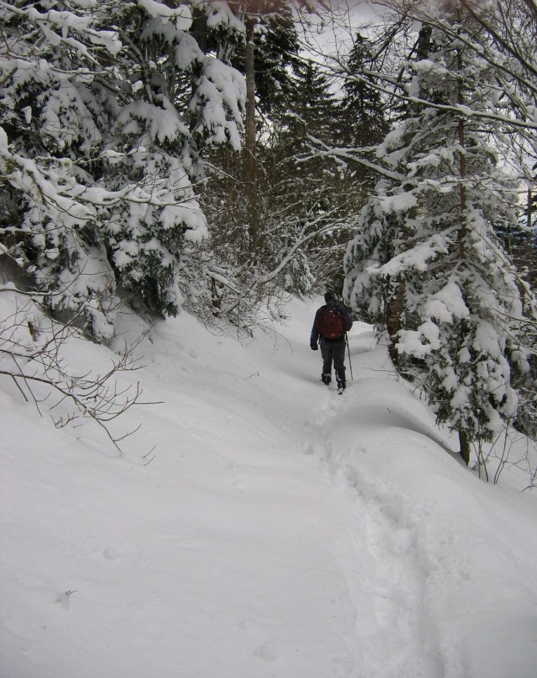
The trail leading up. One other hiker had blazed the trail for us.

There are not many things prettier than spruce trees heavily laden with newly fallen snow.

Sam Baucom took this shot of me at Myrtle Point, near the summit.

The view that day from Myrtle Point.

I got Sam to take this one of me as we left the top of the mountain to head back down.

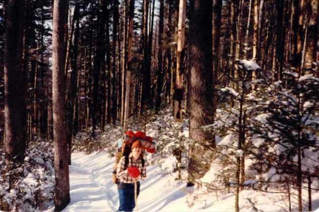
This is from a hike when I was barely 21 years old. We were trying to reach the summit but drifts that were just too deep exhausted us and we had to make camp on a ridge as the sun was setting.
This was what it was like at the base of the mountain. No snow, at all. Mount LeConte here is the only peak in the eastern USA that is one mile tall. That is, from the base of the peak to the top of the peak it is over one mile of altitude gain. The bottom is at around 1200 feet, and the summit almost 6600 feet.


Monday, February 24, 2014

Newfound Gap!

One of my favorite car-accessible spots in the Great Smoky Mountains National Park is Newfound Gap. This is at the highest point on 441, which is the road that bisects the Park and allows visitors to drive from Gatlinburg TN on the north side of the Park over to Cherokee NC on the southern side.

Generally I can't stand being around traffic, lots of cars, and crowds. And you stand a really good chance of encountering all three at Newfound Gap. However, it's also a great way to achieve access to trails that take you to some of the most stunning scenery in the Great Smokies. The Appalachian Trail crosses at Newfound Gap, and you can head off either east or west and eventually find your way to just about any other trail in the Park from here. I have done so many, many times.

And so, although the road in many ways wrecks the wilderness aspect of the Park, it is a glorious place to stop your car and enjoy the scenery, or to begin a backpacking trip or a day-hike. Here's to Newfound Gap! Where Franklin Delano Roosevelt dedicated the Great Smoky Mountains National Park!

You want views? We got views.

From the viewing platform looking down on the parking lot.

More views.

From the parking area looking toward the overlook platform and the Appalachian Trail.

And the Appalachian Trail. March off in this direction and you'll reach one of my very favorite peaks in the Park: Charlies Bunion. Hang a left along the way and you'll travel along the trail called The Boulevard leading to the summit of Mount LeConte.

Wednesday, January 29, 2014

Altitude

Here in the South the mountains are as high as they get in the eastern half of the nation. None of our peaks is high enough to have a snowline (where snow never melts) or even a treeline (where arctic tundra prevails). But we do have mountains that are tall enough to exhibit a great degree of environmental changes between the base and summit. Nowhere is this more on display than in the Great Smoky Mountains National Park, and no mountain shows this better than Mount LeConte.

LeConte looms above the city of Gatlinburg. It dominates the skyline in a way no other summit can in the eastern USA. For it is the only place here that rises so abruptly above its base to such heights. A person can begin hiking at the city limits of Gatlinburg, walk into the Park and end the hike one vertical mile higher on the very top of the peak. LeConte, rising as it does to 6,593 feet above sea level, is one of the highest peaks in the eastern USA. And it is certainly the "tallest", marking probably the only mile-high wall on this half of the country.

When you start your hike at the base of LeConte, you are traveling in typical southern hardwood and pine forests. It gets about as hot in Gatlinburg as it does anywhere else in the South with summer temperatures routinely hitting the 90s. But by the time you reach the summit of that tallest of eastern peaks, the forests are the same as one encounters in southern Canada, and the temperatures never top 80 degrees on even the hottest of days in the valleys below.

LeConte: the mile-high wall above Gatlinburg.

Just a thousand feet or so above Gatlinburg I moved into a dusting of snow and a different forest type (then dominated by hemlocks seen here, but which are pretty much all dead now from hwa infestation).

About 2/3 of the way up the forests become dominated by spruce trees and the snow is getting deeper with every foot I climbed.

At over 5,000 feet the snow was getting seriously deep.

Just before the top of the mountain. It was still snowing as I got there.

Yours truly, on the snow-covered summit of Mount LeConte, March of 2005.

And then it was time to head down, slogging through 17 inches of fresh snowfall until the mountain's varying climates slowly took it all away from me.

Tuesday, June 26, 2012

Tired

Today I am exhausted beyond my ability to convey.

Here are some very, very old photos that Carole found of me. They were taken on a backpacking trip in the Great Smoky Mountains National Park. 1980, I think. The amazing thing about that trip was that I expected some cool temperatures (the second day of the trip was May 1st), but I was not expecting very deep snow. Which is exactly what we encountered. On the way up Mount LeConte the snow was over knee-deep and we never made the summit. Ended up pitching a tent on a random spot on a ridge.

Still hoping to get to the summit. Had to give up some time later.
 And sleeping on hard-packed snow is about the most miserable surface I can imagine for trying to get a good night's rest. The stuff compacted beneath me and dug into my body, even through the foam pad I was sleeping on. I woke up at first light feeling horrible. You can even see by my expression in that initial photo (taken on Charlie's Bunion) that I was feeling the fatigue. The fact of the matter was that I had not been backpacking in about two years when I took that trip, and I was woefully out of shape. And really out of shape to have to tackle hiking through snow almost three feet deep on the ridges of some of the highest mountains in the eastern USA.

Man, I was already tired with many more miles to go that day.
So now, thinking of that trip, I go off to sleep. No writing tonight. The novel will have to wait.

This was very close to the time when we realized we weren't going to make the summit of LeConte.
My birthday is on Thursday. I have that day off and will definitely sleep in.

The sun greeted us. I was sick from sleeping on snow that had compacted to solid ice.

Looking at my trail guide as we descended LeConte and headed down to Newfound Gap.

Thursday, February 09, 2012

Icy Hike from 2005

I'm busy on a writing project so I can't post much this week. I'll run some photos from old hikes.

In March 2005 I hiked to the summit of Mount LeConte in the Great Smoky Mountains National Park with Sam Baucom. When we started the hike we were not much higher than Gatlinburg. Of course over the duration of the hike you gain almost a vertical mile. At the start the temperatures were in the high 50s and there was no snow on the ground, and there was no threat of snow. By the time we hit the summit at 6,593 feet above sea level, there was well over a foot of just-fallen snow on the ground. And it was cold as hell up there. Well below freezing.

They don't call the heights of the Smokies "the Canadian Zone" for nothing.

Sam took this one of me as we were leaving the summit. I enjoy hiking in fresh snow. It was still snowing just a tad as we left the peak.

I took this one as we approached the top of the mountain. Not far from this point you break out in the area where LeConte Lodge is located.

I'm pretty sure that this is the highest outhouse in the eastern USA. It's at around 6,400 feet above sea level or so. Maybe a little higher.

Part of the LeConte Lodge complex. You can only get here via hiking. Still, there aren't many places like this in the eastern USA, so it's very popular and hard to get a room. I've been trying for years but I can never find a vacancy when I have a day off.

Good ol' Bob at Myrtle Point near the top of LeConte. It was dreadful cold up there, but I took off my jacket and cap for this quick photo before I could freeze.

The view from where I was standing.

All of that freshly fallen snow was nothing but eye candy.