Showing posts with label CCC. Show all posts

Friday, September 22, 2017

Morrow Mountain Hike

Yesterday I went on a short hike at Morrow Mountain State Park. I sometimes visit that park when I can't get away to the real mountains. It's less than sixty miles away and I can be there in about an hour if traffic is light getting out of the Charlotte metro area.

The small mountain range there is called The Uwharries. Practically speaking, they are not mountains at all, but rather a range of low hills that persist due to a resistant layer of cap rock consisting of rhyolite and quartz. The range is considered one of the oldest on the planet at over 500 million years. Morrow Mountain, around which the park is set, was an important site to the Native American tribes that settled here thousands of years ago. Rhyolite fractures in a manner similar to flint and is excellent for making edged tools such as arrowheads, knives, axes, scrapers, drills, and the like. If you go to the summit of Morrow Mountain today you will find that it is covered in flakes of rhyolite, each and every one of them the result of tool production long, long ago.

The hike I took was one I had skipped in the past--a 4.1 mile loop called the Fall Mountain Trail. It takes you from the shores of Lake Tillery and over the top of Fall Mountain. It's an interesting hike with a change in vegetation--the flood-plain at the lake shore up to the rocky mountaintop with forests of oak and beech. A number of fires have run through the forest over the past few years and you get the impression of walking through a mature forest because all of the understory has removed through fire, wind, and ice storms. The forest is actually not old or even mature, at all. But because of the fires and storms it is wide and open.

In years past I would encounter a lot of wildlife in the park, but my last few trips there have been rather barren affairs when it comes to wildlife. In fact, I didn't see so much as a butterfly. I heard some locusts in the trees, and a woodpecker was having his way with a tree somewhere nearby, but I saw absolutely nothing living. I think I heard a lizard scurrying away at one point, but didn't see it. I suppose the forest floor has been scoured clean of food and so no wildlife. The oaks were, however, dropping vast numbers of acorns, so if there are any deer, squirrels, or bear still around they will have plenty to eat this season.

My original plan was to hike the Fall Mountain Trail and then go do a couple of other, shorter trails. But the heat became oppressive and I ended up only doing the one trail. One interesting thing that I noted as I climbed the mountain was that the lower and intermediate slopes were rich with quartz, but the highest ridges and summits were full of rhyolite. Some kind of layering there, but I don't know the reason for it.

Park entrance.

I'm pretty sure this building was constructed by the CCC. I do know they had a camp here and built a quarry to harvest local stone for building materials. It's vacant now and the park office is now in the interior of the park.

Along the shore of Lake Tillery near the start of the trail.

Just after I left the flood plain and began to climb the slopes.

You vant rhyolite? Ve got rhyolite.

I had to detour around a number of big trees like this on the trail. Some were victims, I think, of the remnants of Hurricane Harvey, Irma both of which created some windstorms through this area.

This is the only spot I have found in the Uwharries that makes me feel like I'm actually in the mountains.

I stopped for a quick peek at the overlook on the summit of Morrow Mountain before I left the park.

A brief video overview of the hike.

Wednesday, August 13, 2014

Middle Mountain Hike (Part Two)!

After leaving Blue Suck Falls (or, rather, the pile of rocks that was supposed to be the falls), I continued upward, climbing the slopes toward Middle Mountain. The trails were all engineered by the old CCC boys and are excellent ones. They're never very steep and there are often plenty of switchbacks so that you don't put too much wear and tear on your knees.

The day continued to be rather cool for the month, but the humidity was slowly picking up and I was beginning to sweat a lot. I had already decided not to drink either of the two quarts of water I'd brought along until I stopped for lunch, which I hoped would be at the Tuscarora Overlook. I didn't know exactly what the "overlook" was, but as it featured prominently on the maps I assumed it was something worth waiting for.

I charged forward.

The trails are all well signed. Not much chance of getting lost here.

I came to a viewing spot called "Lookout Rock". For a great view all you have to do is scramble to the top of this big boulder.

The view from the top of Lookout Rock.

Up on the rock.

The trail goes along the top of the ridge of Middle Mountain.
American chestnut trees. There were hundreds of them here along the top of Middle Mountain. Of course they'll all die back when the blight infects them.

As I was hurrying along (I'd missed the first turn-off to Tuscarora Overlook and had to take the second access trail) I heard something crashing through the woods. I looked up in time to see the back end of a black bear high-tailing it away from me. The wild ones tend to run away from you as fast as they can. After some distance, it turned to see if I was following. I had my regular lens at highest setting here and you can see the bear in the center of the photo. He was some distance away--you should always keep a healthy distance between yourself and bears.

I hurried to get my best telephoto lens attached and the bear moved away a little more, but I was able to capture this last image before he vanished into the forest.

This little cabin sits at the Tuscarora Overlook. It's open to public day-use only. For relaxing and shelter from rain. They do not want hikers to make use of the fireplace, and it's not for overnight stays. The kids here were all part of the YCC (Youth Conservation Corps), a kind of watered-down version of the old CCC. When I was in high school I tried to secure a spot in the YCC, but was unable. Competition in those days was just too fierce. The kids told me that these days it's very easy to get a spot, as long as you're not insistent on a particular location, such as a popular National Park. Their job was to clear the overlook of mountain laurel which had obscured the view from the cabin. They did a good job. The guy on the bicycle is a Douthat Park volunteer.
Inside the little cabin.

I took this shot from behind the cabin looking toward the area the YCC fellows had cleared of brush.

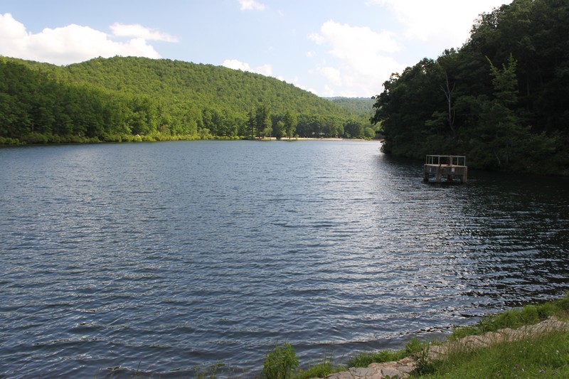
And the view from Tuscarora Overlook.

The view you get because the young guys hacked away all of the brush and shrubs.
I had a snack there at the overlook, drank one of my quarts of water, and took it easy for a few minutes. Then I thanked the volunteer and the YCC folk for their hard work and headed on. Later...part three.


Thursday, May 31, 2012

More Work by the CCC


Once again--as if I needed to be reminded--we were faced with how much we owe to the works of the old Civilian Conservation Corps. The Sherando Lake Recreation Area where we spent a full day of enjoying ourselves under a clear blue sky is itself the product of the labor of the CCC. You can't stand anywhere in this recreation area without witnessing the results of their work.

There are two lakes here, both dammed and created by the CCC. There are a number of structures, one of which is absolutely spectacular and which was built by the Corps. It serves as a bathhouse, a picnic pavilion (with TWO huge fireplaces), a vending building, and a camp store selling ice, matches, and anything else you may have forgotten on your way to enjoying a cookout at the park.

What is always foremost in my mind when I see these places built by the CCC is that when they arrived here there probably wasn't much to see but the ruined lands denuded by timber companies. I doubt that there were many trees here more than a decade or so in age. The southern Appalachians were pretty much totally denuded of forest cover by the 1930s, and I will assume this spot was no different. It wasn't just to build lakes and campgrounds that the CCC busied themselves. They were also instrumental in laying the groundwork for the restoration of our native forests that had been so terribly ruined by the timber companies.

The main bathhouse, built by the CCC.
 

Trees, buildings, facilities, brought to you by the sweat of the CCC.

Two enormous fireplaces in the pavilion.

Carole under the pavilion. Look at that floor!

This guy had a really neat pontoon boat, complete with electric trolling motor.

Bottom of the spillway. The creek below here is a stocked trout stream.

Staircase leading up the spillway to the top of the dam.

Water going over the top of the spillway.

I forgot to take a good photo of the dams in the recreation area. But I did manage to remember to take a shot from atop the dam looking out on the lake.

I took this one mainly to illustrate the detailed and meticulous rock work on the retaining walls.


Saturday, May 19, 2012

An Idea Whose Time has Returned


Almost everywhere I go hiking or backpacking or camping in our National Parks, National Forests, or State Parks I generally encounter the work of the old Civilian Conservation Corps. Everyone who enjoys our wild and rural lands tends to know what the CCC was. But a lot of folk don't know.

The CCC was implemented by the Franklin Roosevelt administration to provide work for the vast numbers of unemployed men in the USA during the Great Depression. And it was the kind of work that would create infrastructure for our parklands that would last, quite frankly, for many, many decades. It has now been almost 100 years since the start of work by those CCC boys and the trails and walls and ponds and shelters and buildings that they constructed are still with us and still in use.

It would  be nice to see the CCC reconstituted and people put to work again doing the kinds of things that were done in those desperate years of the 1930s and early 40s. It was socialism at its finest and it worked well for all. And this is why it will likely not be put into operation again; not as long as corporate interests run our nation. But maybe some day.

Here are some photographs of a building constructed in Florida by the Civilian Conservation Corps. It's still in use and can be seen in O'Leno State Park.


Think of the dances!
The kind of finishing touches only folk in the CCC thought about.


Tuesday, June 29, 2010

Escaping the Heat Part II

On Sunday we escaped the heat of Charlotte for the high country near Mount Mitchell. One place that we had visited briefly in the past but never stopped to enjoy was the Carolina Hemlock Recreation Area. It's on NC 80 a few miles from the Blue Ridge Parkway. It was developed many years ago by the Civilian Conservation Corps, in the days when socialist programs could be enacted and put in place without too much screaming and stomping by right wing elements in the government. Those were the days, by gosh!

The main reason for this spot being placed here by the CCC boys is that this particular area on the South Toe River has a few very nice, very deep swimming holes. One of these has a set of rock stairs and a retaining wall so that it serves now as a kind of beach. When we arrived, we were the only ones there, but we knew that would change as the day progressed. So in short order we paid our $3.00 day use fee and picked out a picnic spot all to ourselves and prepared the grill with charcoal and the table with food and such. While Carole was getting the grill ready for cooking, I explored the river and searched out the various swimming holes.

Once upon a time the recreation area was green with the namesake hemlock trees. But now the only healthy hemlocks are the ones that have been treated against adelgid infestation by the application of insecticides. You can tell by the health of the various stands of trees how much money the National Forest Service had to spend at each step of the insect plague. The hemlocks closest to the bathrooms at the campsites look like hemlocks are supposed to appear--fully green with thick needles and lots of new growth. Hemlocks further out from there look sick, but perhaps in a state in which they can survive if the nicotine-based chemicals have been applied in time. And farther away than those, you can see the trees that are a lost cause, although some of them have been marked as having been treated--too late. And, of course, there are the dead hemlocks standing bare and ghostly everywhere around where no one had the funds or foresight to treat them.

After I explored a bit and we took some photos, we just relaxed and talked. In time, we cooked up some Polish sausages with sauerkraut and mustard and had potato salad with them. They were delicious. After that, we packed up our stuff and drove a few yards to the beach parking and walked down to the water's edge and jumped into the cool waters of the South Toe River. We had a great time just soaking up the sun and swimming back and forth and up and down the swimming hole. The water is deep enough so that you can safely jump and dive into the pools. As we knew, the crowds grew as the hours passed until at some point the beach was packed from end to end with families and couples doing as we were--enjoying the recreation area.

Toward 2:00 pm the numbers of people were grating on our need for solitude, so we gathered up our stuff, took a few last photos, and then headed up the road to see a couple of other places that were on our agenda. More on that tomorrow.


Minerals Museum and Blue Ridge Parkway Visitors Center at the intersection of the Parkway and NC 226. I like this spot and almost always visit it on drives along the Parkway.

The rhododendron was in full bloom. I took this shot almost as soon as we pulled in to the Carolina Hemlock Recreation Area.

My simple Canon A1100IS isn't the best camera on the market, but sometimes I can capture a nice shot or two when I'm playing around with the macro settings. This blossom was busy with these tiny black bumblebees. These are the type of bee that stung me on Wilson Creek last year and caused me to drop my camera into a waterfall.

This is the picnic pavilion at the recreation area. You can rent this for the day. The barbecue pit on the right is double sided and you could likely grill up some huge sides of beef or pork on those babies. They keep this place very clean and in good order.

Stairs leading down from the pavilion to the South Toe River.

From the river's shore looking back up at the pavilion.

Each hemlock tree that has been treated against Hemlock wooly adelgid has these little tags nailed on them. In some cases, the trees were dead anyway.

Carole roasts yellow corn for lunch! Yum!

This was our picnic spot right by the South Toe River.

Carole took this of me in the deepest pool. You can see people leaping into the water behind me, and kids sitting on a boulder in the middle of the river.


This was the big swimming hole above the official beach area.


Nice Ron Paul article for those of you still too stupid to see how evil he and his son are.

Wednesday, September 30, 2009

Determination = Reward

When we couldn't find a safe non-technical route to the top, Andy and I retreated to a lower vantage point to scope out the peak. I had been told time and again that there was a relatively easy route to the top. However, every spot we had checked involved some moves that could put you in a deadly situation if you were to slip. And I'm not talking about falling a few feet--these would be tumbles of anywhere from a couple of dozen to several hundred-feet sure death plummets.

I just kept looking at Babel Tower, knowing that there was a Class II/III route to the top that we weren't seeing. I did not want to have devoted the day to driving up there and hiking to the peak just to return home without having bagged it. It was only about fifty or so vertical feet of mountain, but it was the difference of having reached the summit, or failure.

Since Andy was really bushed from our previous attempts to get to the top, and he was not as into bagging the summit like I was, he stayed where we had lunch while I went to look one more time to see if we missed something. (I knew we had.)

Climbing back up a trail that I could tell others had used, I went to the point where we had initially looked and had retreated when it looked like a sheer drop off. This time I pushed some low branches aside that were blocking the view, and realized that the trail did not come to an end, but in fact continued around the mountain on a wide ledge. Stepping out on it a few strides, I could see a well-traveled path that led right up through the rocks to the top!

As quickly as I safely could (it was still something of a scramble), I got to the top of the Tower as fast as I could so that I could call down to Andy. He heard me, looked up and waved. But he wasn't keen to join me and was content to wait while I took photos.

I'm glad I was persistent and found the route to the top. The views from there were quite good, and it was a rewarding experience to peer down on the hairpin curve in the river, Babel Tower standing watch over that terrific bend in the waterway.

Keep on keepin' on, as my dad used to say.

This was the pathway that I located at the point where we'd originally given up.

The tip-top of Babel Tower.

Looking down from the edge.

View of the Linville River.

View from the top looking south down the Gorge. Table Rock blocking the way.


After grabbing our daypacks, we started the long climb back to the parking area.

They don't call it a wilderness area for nothing. This trail was built by the Civilian Conservation Corps back in the 1930s, and it's still a good one.

After 3+ mile round trip hike (plus much climbing and scrambling at Babel Tower), we approach the parking area where we'd left the truck. It was time to head back home.