When Carole and I first started taking our vacations, she would always suggest side trips along the way to my hiking, scrambling, backpacking, waterfall wandering destinations. These side trips almost always included historical sites. In my younger days, I would ALWAYS balk at these suggestions and only give in grudgingly. The only history I was interested in during those earlier times was natural history. Plate tectonics, erosion, uplift, forest succession, species extirpation/reintroduction--these were my historical interests.
 Carole, last week just before her **** high school reunion.
  There is some debate on what the houses at the initial colony looked like. Were they wood, or wattle, or a combination of both? This is what the museum's folk have settled on. This design is similar to some of the housing being constructed in the colonies (and in Europe) during the time of the settling of Charles Towne Landing.
 Rear view of the house, bordering the marsh, showing the chimney, composed of wattle and timbers.
 Inside view of the fireplace.
  Dining/living area. The floors were earthen.
  One of the earthen ramparts erected to defend the colony. Part of the initial reason for the colony was to create a foothold in the Americas to compete with the Spanish and the French who had concurrent claims on the land. The fort never actually saw battle, but it was well secured with both walls and weaponry.
 Composite shot of the earth walls and trenches to defend the colony.
Video of the fort area with cannon.
 Just past the fort we came upon a full-scale replica of one of the types of merchant ships then in use. These were used to transport goods from the colony back to other, established colonies in the Caribbean, and to Europe. They looked rather small, but could hold enough cargo to make the trips profitable between markets.
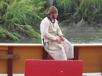 This fellow was dressed in period attire and singing shanties. He was also a wellspring of information regarding the ship and the colony.
 This is actually a working ship. It does make trips to sea.
  Access to crew quarters and the cargo area.
  The bow of the ship. There were bunks fore and aft. Two bunks on either side. For a total of eight bunks. Sleeping in shifts, the ship could make use of a working crew of sixteen, not counting officers who had their own sleeping area.
 Shot of the inside of the bow. This is a relatively new ship and still smelled of fresh pine wood.
 A view of the rigging of the center mast.
  A hull under construction.
  Beyond the ship was the replica of the stockade area of the colony. The stockade walls in the distance protected the colonists living and working inside. This fence was to protect a replica garden from marauding critters.
 Timber and wattle shed for use in farming and gardening.
 The stockade walls. When I took this shot I stood in the grass. This was the only place where the mosquitoes found me. I can't say why. But I quickly retreated and the mosquitoes vanished.
 As I said earlier, all of this historical property was owned and improved by some rich broad. Originally it had belonged to her grandparents. When she bought the joint from her siblings and other relatives the house was in ruins and goats were living in it. She spent a fortune fixing it up and expanding it. This was our first view of the house down the wide avenue lined in live oaks that she had landscaped for maximum effect.
 A closeup of the rich broad's house as you get to the vast front lawn.
  This was the pond in her back yard. Today the house and grounds are available for meetings and weddings. The pond is apparently full of alligators. Watch the kiddies!
 They're not kidding about the 'gators.
  The back of the mansion. there is also a secondary house just out of sight on the left. I suppose it was servants' quarters from back in day.
 This was the pathway that I located at the point where we'd originally given up.
  The tip-top of Babel Tower.
 Looking down from the edge.
  View of the Linville River.
 View from the top looking south down the Gorge. Table Rock blocking the way.
  After grabbing our daypacks, we started the long climb back to the parking area.
  They don't call it a wilderness area for nothing. This trail was built by the Civilian Conservation Corps back in the 1930s, and it's still a good one.
 After 3+ mile round trip hike (plus much climbing and scrambling at Babel Tower), we approach the parking area where we'd left the truck. It was time to head back home.


