Friday, February 10, 2012

Wilderness

I love camping in wilderness areas. Especially in wilderness areas that are not really popular and which remain uncrowded. More than anything else, I enjoy solitude when I go into such places.

One of my favorites is the Middle Prong Wilderness. Because it lies very close to Shining Rock Wilderness, it doesn't get the kind of traffic its more popular and admittedly more striking neighbor receives. This makes it perfect for me.

The backpacking trip I took in there in 2005 was great. I had the whole place to myself. I encountered only one other hiker in the joint and he was just a day-hiker on his way out as I was making my way in. Solitude? You better believe I had it.

This was also the trip where I got lost in the red spruce forest near my campsite as night was coming on. The time I panicked and ran screaming through the woods like a little girl. I thought I was going to spend the night huddled in the woods freezing my ass off. But I calmed down, found a clearing in the forest, and figured out how to get back to camp.

If you're hunting for a wilderness area with high mountains, good forests, some open country, and lots of solitude then I recommend Middle Prong Wilderness.

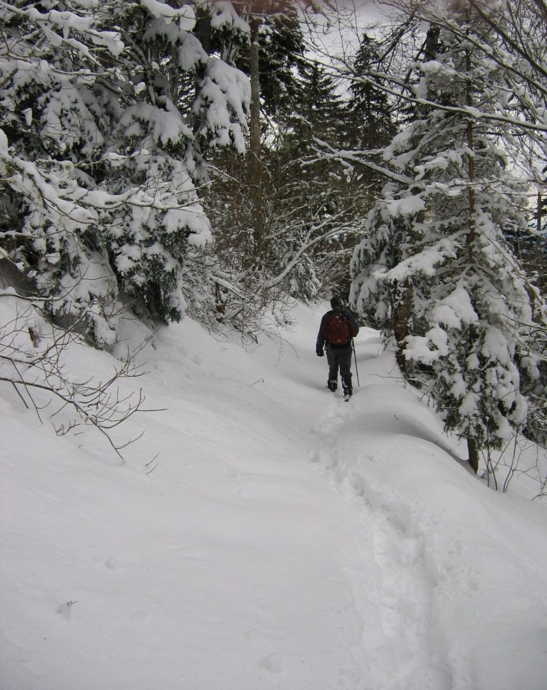
A self-portrait I took as I entered the wilderness area via the Mountains to Sea Trail.

Tilted rock formations at the campsite near Green Knob where I pitched my tent.

Me with my two-man tent. I still have that tent, but prefer to use my MSR one-man tent these days.

360 degree panorama of my campsite. Click to embiggen.


I'd like to bushwhack to this waterfall some day. It's located in the wilderness and drains off from a very high plateau near Mount Hardy. It has to be one of the highest (above sea level) waterfalls in the eastern USA.

Thursday, February 09, 2012

Icy Hike from 2005

I'm busy on a writing project so I can't post much this week. I'll run some photos from old hikes.

In March 2005 I hiked to the summit of Mount LeConte in the Great Smoky Mountains National Park with Sam Baucom. When we started the hike we were not much higher than Gatlinburg. Of course over the duration of the hike you gain almost a vertical mile. At the start the temperatures were in the high 50s and there was no snow on the ground, and there was no threat of snow. By the time we hit the summit at 6,593 feet above sea level, there was well over a foot of just-fallen snow on the ground. And it was cold as hell up there. Well below freezing.

They don't call the heights of the Smokies "the Canadian Zone" for nothing.

Sam took this one of me as we were leaving the summit. I enjoy hiking in fresh snow. It was still snowing just a tad as we left the peak.

I took this one as we approached the top of the mountain. Not far from this point you break out in the area where LeConte Lodge is located.

I'm pretty sure that this is the highest outhouse in the eastern USA. It's at around 6,400 feet above sea level or so. Maybe a little higher.

Part of the LeConte Lodge complex. You can only get here via hiking. Still, there aren't many places like this in the eastern USA, so it's very popular and hard to get a room. I've been trying for years but I can never find a vacancy when I have a day off.

Good ol' Bob at Myrtle Point near the top of LeConte. It was dreadful cold up there, but I took off my jacket and cap for this quick photo before I could freeze.

The view from where I was standing.

All of that freshly fallen snow was nothing but eye candy.

Wednesday, February 08, 2012

Unpublished Photos from Black Mountain Crest Trail

Back in 2005 I took one of my Black Mountain Crest Trail solo backpacking trips. As I recall, I pretty much had the whole trail to myself. I did pass two other hikers, briefly, just after a downpour. During such a downpour, parts of the "trail" quite literally become waterfalls. This is because the trail ascends/descends sheer faces of rock. I couldn't get any photos of this when it was happening because it was raining far too hard to take my digital camera out of its camera bag.

This was not a trip for long-range views.

I had taken this particular backpack to bag a few peaks on my list. This I was able to do, but true to form, the Crest Trail totally kicked my ass. I hiked it during one of my lardass periods, so that didn't help.

Following are some photos of the trail that I've never shared.

As I recall, this is part of the trail just after you pass the top of Winter Star and descend beyond it heading toward Gibbs Mountain and Horse Rock. The trail here is very darned rugged and it's easy to get lost just past here where the trail enters one of the red spruce forests that are my personal kryptonite.

This is actually the trail. During warmer months it is not very well maintained and so the plants and shrubs conspire to hide it from hikers. You just have to assume it's where it should be and hope you don't wander off onto a cliff.

Once again, the trail is under there somewhere. Just make the best guess and push on.

This was a summit on my list. I think it was Gibbs Mountain. I had a hard time finding the high point in the pea soup that passed for atmosphere that day. By this time I was pretty much soaked to the bone and exhausted. I still had another peak to bag, then a return to the gap where my tent was pitched where I had to break down camp, pack it away, and then hike five miles beyond to where my truck was parked. The effort damned near killt me.

The high point of Celo Knob that day. I was happy to bag that bitch, but Great Humping Jove, I was tired.

This is a strange point. If you don't turn aside here, you will quite literally walk off a cliff, the edge of which is hidden in the shrubs.

Tuesday, February 07, 2012

The Sick Hike

In early 2005 I was still trying to locate the Sag Branch Poplar. Initially I only had a vague idea of where it was. Later, Will Blozan of ENTS gave me specific directions. So I had them with me very early one morning as I got up before dawn and headed to Cataloochee to finally find the tree.

Imagine my surprise, on arriving at the trailhead in the early light, to discover that I'd left those instructions at home. I didn't realize as I headed away from my truck, that the lack of directions would soon be the least of my problems.

So, once again, I was left to try to locate the biggest tree in the Great Smoky Mountains National Park by trying to recall landmarks only vaguely described to me. Still, I set out with some hope that I'd find the tree at last and get some decent photos. At this time I was still almost exclusively hiking alone, and I was at just about my heaviest in many years. I weighed about 230 pounds around this time but, as always, I never had any trouble hiking steep slopes or bushwhacking off trail. Even at the worst of my weight gains I tended to have enough good lung health to tackle the toughest slopes.

The thing about this particular hike, though, was what happened after I'd hiked about three miles into the forest:

At pretty much the halfway point in the hike, I realized that I was sick. Not just feeling a tiny bit under the weather, but completely sick. A flu bug had invaded my body and picked that precise moment to let me know that it had its hooks in me. As I walked along I got sicker and sicker and knew that I was going to have a long, difficult, painful hike back to my truck. The worst part was that I was precisely in the middle of the route on the Boogerman Trail and so I decided to just push on rather than backtrack. Either way was equal in distance and I recalled from earlier visits on the loop that each way back was as good as the other.

So, for the next couple of hours I would hike for a while, stop and rest, then continue on until I had to stop and rest again. I was truly and completely sick. Fortunately, I was well dressed against the cold and I had plenty to drink and even food to eat if I hadn't been too damned sick to think about food. Trying to find the Sag Branch Poplar was out of the question. There was no way that I was going to be able to trudge off trail in the ice and snow to locate the tree, so I stayed on the trail and made my way agonizingly back to the road in Cataloochee.

After several very miserable hours I got back to the truck. I climbed in, drank some more water, and warmed up. There was now the task of having to make the two-hour drive back home. I seriously considered just finding a hotel room and holing up for the day and evening, but I decided against that and instead made the decision to tough out a drive back home. If anything, the drive home was as miserable a the hike had been, but I got home well before dark and ended up taking a hot shower and climbing into bed, where I pretty much stayed for the next few days.

Later, I did manage to find the Sag Branch Poplar. Fortunately I was in much better shape on that trip and the previous attempt was by then just a very nasty memory.

My first long-range view as I drove into the park. (Click to embiggen.)

It had just stopped snowing as I got to Cataloochee. Only the rangers had been on the road--one of them I encountered told me to close gates behind me as I drove in--he said I was okay because I had four-wheel drive.

As I hiked into the forest I was surprised to note that the only other being on the trail that morning was a coyote.

I stopped a couple of times to take photos of the coyote tracks.

I stopped on the way out to snap a few self-portraits. At this point I was extremely ill, but not too sick to want to capture some shots of me in the big forest.

I think this hike was the last one I took when there were still lots of living hemlock trees in Cataloochee. Go there now and every single hemlock you encounter will be a dead husk.

One of the historic buildings in Cataloochee that has been preserved.

And I had to pause to snap a few shots of the elk. I will never be able to get over the fact that elk have been returned to the southern Appalachians.

And a parting shot from an overlook of the incomparable ranges of my native South. After this, it was a long and excruciating drive back home to a warm bed and much needed rest.

Sunday, February 05, 2012

Gone Forever

I was sifting through older digital photographs today and happened upon a number from hikes at one of my very favorite places: The Black Mountain Crest Trail along the spine of North Carolina's Black Mountains. These are the highest mountains in the eastern United States. This particular trail is one of the toughest I've ever hiked. It's only about twelve miles long, but all of the constant ups and downs and the extremes of topography means that it has never failed to take me to the limits of my physical abilities. I generally end up all but crawling back to my starting point.

One of the very few photos I have of the old lookout tower on Mount Mitchell. I took this one from near the top of the second highest peak in the eastern USA, Mount Craig.

For some reason, in most of my hikes there, I would generally stop off at the lookout tower on the summit of Mount Mitchell (the highest point in the range), but I never took a good photo of the old tower! It was a strange design for a tower, and rather unique in its way. However, it was apparently pointed out somewhere along the way that it was not user-friendly for disabled people. And so the decision was made to tear it down and rebuild a lookout tower that was more accessible to people who can't walk.

Now, my own opinion about such things is basically that life isn't fair. And our high points are not curiosities for those who can't or shouldn't be there in the first place. Almost every high point in the eastern USA has had a road carved to its summit so that lazy people can drive there. It's a travesty. I would love to see the auto roads carved into places like Brasstown Bald, Clingman's Dome, Mount Washington, etc. to be torn up, filled in with native earth and replanted with native trees and shrubs so that such roads would--in time--become bad memories on the faces of these great peaks.

Hiking with lardasses. (Theme for a later blog.) One of my pals chooses carefully when he goes hiking with groups, trying to avoid hikes that include a bunch of lardasses. My own weight fluctuates wildly. Sometimes I'll weigh as much as 240+ pounds, as I did on this backpack on the Black Mountain Crest Trail. Other times I'll weigh around 185 or so. Fortunately for me, even when I'm a lardass, I have always been able to hike on steep mountain slopes. But, yeah, I prefer not to be a lardass.

So, to get back to the point, the old tower was removed from Mount Mitchell. It was slowly torn down, rock by rock, until the old surface was revealed and the new lookout point was put up--also slowly. Weather on Mitchell can be tough (to make an understatement) and it finally was completed. Today, folk in wheelchairs and on crutches can roll and hobble up a slight incline to a wide concrete surface to take in the view. Indeed, the new tower is less harsh against the skyline than the old one. It has that going for it. I don't know what plans the park service has for the day when the recovering balsam forests begin to rise up and block the views. For such a day will surely come if the acid rain and balsam wooly adelgid do not once again combine to kill off these forests as they did in the 1980s and 1990s. I fear they'll cut down the recovering trees so that the lazy and the disabled won't be inconvenienced.

Friday, February 03, 2012

Last February

Man, the weather has surely been different this winter than last one. This winter...well, we haven't even had a winter. The past two weeks I have worn shorts and short-sleeved shirts to work. And the temperatures have been so high that I've had to deal with humidity and sweating. I don't know about the rest of you, but this human-caused global warming sucks ass. Winter is supposed to be cold at this latitude!

Last year, the ski slopes were deep in heavy snow. The ski resorts rarely had to even use the snow-making machines. It pretty much snowed the entire winter. When Carole and I were in West Virginia and Maryland last February, we saw snowdrifts ten-feet deep. We hiked on packed snow three feet deep in Cathedral State Park. It snowed almost continuously during our visit there.


Now we're back to these hellishly abnormal weather patterns caused by the release of carbon that had been sequestered in the Earth's crust for hundreds of millions of years.

The Earth is screwed.

Thursday, February 02, 2012

Billy Graham

I saw this piece of art online years ago and copied it.
Link

The work is by a comic book artist who I recall from the 1970s. His name was Billy Graham. Yeah, tough act to follow, right? But he had a unique style and I really dug the stories he produced for the Warren horror magazines of my youth. He was one of the better artists to work at Warren once they stopped paying the kinds of rates that kept the likes of Ditko, Williamson, Crandall, etc. at the company.

He went on to work at Marvel Comics illustrating LUKE CAGE, HERO FOR HIRE. I think he started on the title inking over George Tuska's pencils and eventually took over the book for a time. According to Wikipedia, he died in 1999. I have no idea of the cause of death. He was a very talented fellow.

Wednesday, February 01, 2012

Found Photos

Back in 2003 I was just getting my old hiking wanderlust rekindled. One of my first trips back to get into finding the old solitude again was a quick car-camping trip to the Smokies in November of that year. I ran up to the Park alone with my two-man tent and a few supplies and camped at Elkmont. I only did a couple of hikes before heading back home, but I had to get back up to the high country again.

I stumbled upon these photos on disk. Taken back in the day before I had a digital camera. These were with my old Canon 35mm film camera. Among the last photos I took with that camera, I'm sure.

One thing that I'm not sure of is the month I took the hikes. But I didn't get them developed until November of 2003.

Red spruce along the Alum Cave Bluffs Trail.

One of the views that drew me up there.

Peregrine Peak along the Alum Cave Bluffs Trail. When I was younger I always wanted to bushwhack to this peak and climb it. Now I'm not so sure I could handle the attempt.

Myrtle Point on the top of Mount LeConte.

Tuesday, January 31, 2012

"Editornomicon"

Here's a story I wrote long, long ago. It never saw print. For the first time on the Internet. This is a pared down version that I submitted to a couple of flash-fiction markets after failing to sell the original (longer) version:

EDITORNOMICON

by

James Robert Smith


Perry placed her hands atop the manuscripts. Upon her desk, four pillars of envelopes: 8 1/2 inches by 11 inches on a side, twelve inches high. She edited APPALLING, The Magazine of Horror; and she had finished the latest issue and had to return these 200 stories: rejections. There were some authors she had counted upon to deliver the effect she always aimed for, but who had not made the cut, this time.

This was the effect for which she was searching. Editing was an art form, but she'd never crossed the line that would satisfy. Critics praised her. It was only that she, Perry Hagopian, had never been satisfied.

She'd done it: a wonderful, terrible achievement.

She had the combination of fiction for which she had always searched. She had eliminated her editorial and all advertising. That had meant the budget would be strained, but she had made the printer's bill. She had what she wanted: the perfect issue.

Perry had a story from Cain Warner, the contract in her desk. It had been one of the last things he had signed for he'd died the day after it had been posted--alcoholism, they said. Perry heard the news before the contract arrived. He was one of her favorites, but she had held the contract to her and breathed a sigh. His novella was the core, the anchor.

There were three posthumous stories. One arrived from the author's mother, a letter informing Perry that the writer (a youngster named Cynthia Packard) had committed suicide the year before. Cynthia's mother had found the manuscript in an envelope addressed to APPALLING. I want you to see this story, her mother had written. I couldn't understand my daughter, but she wanted you to publish this. Perhaps you will like it. Indeed. A story of enormous anguish, and she was thrilled with it. This would put Packard's sad name on the genre's map.

She had a story by the late Manuel Manfred. His agent had contacted her saying that he had located an unpublished story from Manfred and that he thought her magazine would be the place for it. It was.

The remaining were by three regulars. She knew them all. William took his pain and squeezed it through his pen: a dyslexic, he couldn't use a keyboard. With effort, he wrote his stories a letter at a time, in block print, checking each word. His manuscripts broke all rules, but his first cover letter had touched her so that she had read the story. All of his stories had been wonderful, and this one was the best.

Conrad lived nearby. He was a sad man, engaged in a painful relationship with an abusive lover. Once, she had seen him with his eye blackened and his lip swollen. A man such as Conrad could have his pick of lovers, and she couldn't understand why he would put up with the one he had. But it must have made his fiction powerful. Her pulse raced every time she read one of his stories. Poor Conrad.

Finally, Terrance. He wrote television; such a waste. But who could refuse that money? Perry had met him two years before. The writer of popular shows, she was surprised when he had approached her. "I have some stories," he said. "They aren't appropriate for many markets, and I was wondering if I could send them to you." How wasted he was on television. "I hardly have time for my own writing", he'd said.

The stories filled the magazine. All expressed operatic pain. She had saved herself the back cover: At last, it read, and her autograph. She had paid the printers, the magazines were on their ways to distributors and shops and subscribers. On her lap was a copy, the cover glistening, reflecting a light she could only think of as evil.

Outside, Perry's husband was banging on the bolted door. It would take him a long time to break in. He had noticed his gun missing. She didn't want to go out that way, but realizing she'd finally done it--well, it was time. To jigsaw such a work of consuming depression: this was her masterpiece. And the final act was to tag her death. How could anyone read those works and refuse what they demanded?

The struggle was over. Still, she was curious how many deaths would be spawned by the readings. The poor miserables, once they realized, would have no choice.

Perry examined the chamber. Time to finish editing.

Bang

Monday, January 30, 2012

THE LIVING END

When there is no more room on your bookshelf,

buy the Kindle version of THE LIVING END!


"Finally! A zombie novel with brains, as well as guts!"--T. Watkins.


Saturday, January 28, 2012

Friday, January 27, 2012

My Favorite Waterfall

This waterfall (it has no name) was pretty much my favorite one of the day. It was below Yucca Falls and was part of an extensive series of slides and cascades that led down to this pretty darned spectacular view. I think that if you climbed the slope on the right you might be able to find a spot where you could see more of these slides and cascades as a single piece.


In this video are Boone the Dog, Jack Thyen on the right, Andy Kunkle on the left, and Johnny Corn at the highest point.

Thursday, January 26, 2012

Eye

The actual eye of one of the world's largest birds. Much as I imagine the eyes of Titanis walleri to have looked in my novel, THE FLOCK.

My agent tells me that I'll probably get edit notes on the sequel THE CLAN very soon. It'll be good to see the book make its way toward publication.

Wednesday, January 25, 2012

GPS

Brenda Wiley made this GPS graph of our hike on Sunday. You can see why we were all so tired by the time the hike was done. We gained, lost, regained, and lost again quite a lot of elevation. Some of the slopes were extremely steep, and there were some off-trail stretches that were really sketchy. I wouldn't suggest this kind of hiking for everyone.


This waterfall actually has a name, apparently. We've been told that it's called Yucca Falls. I don't know why that name was applied.

Yucca Falls.

Tuesday, January 24, 2012

Choices


Between my day-job and my writing job I have hardly any time to myself. That is, I don't have much time to pursue my hobbies and other interests. Even my reading time has suffered in the past few months because I stay so busy with my two jobs.

One of my hobbies that has suffered quite a lot because of this is my love of the outdoors. There are not many things that I enjoy more than hiking and backpacking. But in the past year I have not had a lot of time to engage in those pursuits. The past two weeks I have pretty much forced myself to go hiking despite having a couple of writing deadlines hanging over my head. Fuck it. I had to get out of the house and out from behind the keyboard for at least a couple of days.

That's the difference, I reckon, between the kind of writing I did in my youth and the kind of writing I do now as an older man. Back when I was young I wrote on 100% enthusiasm and inspiration. Now I write on a pure work ethic and a solid knowledge of how to create a story. The difference between the two is that one was a pursuit of fun and the latter is the work of a learned craft.

But as much as I love writing, I have to get away from it from time to time. I think that I'll be hiking more this year than I did last. It's either that or drive myself completely stir crazy sitting here in the office every day after I get home from my day-job, and spending my Sundays typing away at this keyboard while my pals all climb mountains or wander around in the wilderness hunting for waterfalls. Too many hikes missed with friends, and too many camp-outs and canoe trips missed with my wife.

The forests and rivers are calling. I'll listen to them more.

Monday, January 23, 2012

Secrets of Table Rock State Park

I went hiking yesterday with some friends. Andy, Jack, Johnny, and Brenda. Johnny Corn had suggested that we head over to Table Rock State Park in South Carolina. He'd recently been given detailed information that there were several recently discovered waterfalls in the park that were off trail and largely unknown to virtually all park visitors. We would have to do some bushwhacking to see each of these waterfalls, so the hike would be a strenuous one.

We used the Palmetto Trail to access the park. The terminus we used was in the campground section of the park which was surprisingly completely vacant. There's a large parking lot at the trail head that we used and soon we were heading up into the high country.

South Carolina's northwestern edge is very mountainous and the Blue Ridge Escarpment rises abruptly here. The elevation roars up from a few hundred feet above sea level to over 3,400 feet in a brief distance. This sudden increase in elevation produces conditions that have been conducive to a vast and varied ecosystem. It also is one of the most conducive for the creation of waterfalls. The area is packed cheek by jowl with, quite literally, many, many hundreds of top-notch waterfalls.

We were there to seek out seven of them. Seven that not many visitors to the park are likely to see, and six of which not many visitors to the park have ever seen.

I'll be posting images and video of our quest to find these waterfalls over the next few days.

This is the first waterfall we visited. We used an obviously well-known if unofficial trail to access it. The trail has had no engineering at all other than people using the most logical route to the base of this very high waterfall that plunges down the escarpment in a series of big plunges. The total height of the falls has to be close to 200 feet.

Another of the falls. This one was about 18 feet tall. Very pretty. It was the first of the five that we visited that required a full-on bushwhack to visit. There is no trail at all to these final five waterfalls. You have to go completely off trail and pick your way through the very rugged and lush terrain of this high southern land. The going is rugged and, at times, frankly dangerous.

This enormous waterfall lay just below the one in the previous photo. It is amazing to think that the park hides waterfalls such as this one. Places that most park visitors will never see and never even suspect.

I really liked this waterfall. It was farther below the one in the photo above. The river rushes down a kind of staircase. A total rush of sensation.


I think this one, the most easily accessible, is known locally as Rainbow Falls. There's a well trod but unofficial trail leading from the Palmetto Trail to the falls.